
 SUMMER STORMS:
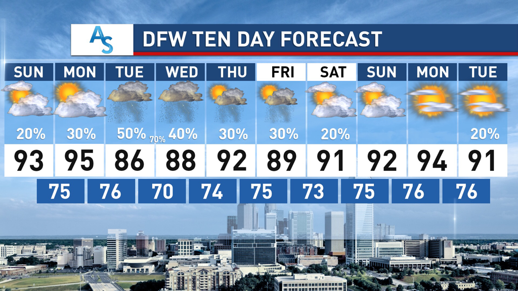
After weeks of dry, hot, summer weather, much of DFW saw a return to rain on Friday. Some isolated areas got upwards of 5 inches overnight, with most areas getting at least an inch of rain. While we returned to clear skies for the weekend we can expect this new rain trend to continue for the next week. The pattern has shifted from our dry spell and, due to our NW flow, more shortwaves will come this week with rain totals that could exceed 5 inches for parts of North Texas. EARLY WEEK: A low pressure system will move down the Texas Panhandle on Monday and produce a shortwave that will move southwest into DFW producing a MCS which could dump a major amount of rain on Tuesday and Wednesday for North Texas. There are varying model solutions for those two days but it is likely that storms will come in late Tuesday and persist overnight through Wednesday. The European model is extremely aggressive and shows bands capable of producing over 10 inches of rain for parts of Texas and it is unlikely that a solution like that unfolds, but could develop if all the right conditions are in place. I’m leaning towards only 2-3 inches for DFW but it’s important to monitor what will happen as the low pressure system moves over Texas and as the shortwave develops. In addition, temperatures will be, on average, 5-10 degrees cooler than the weeks beforehand, with Tuesday potentially struggling to get past 85 degrees. While this will be accompanied by humid weather, potentially raising the heat index, it’ll hopefully be a nice change for us. LATE WEEK RAIN: Rain is possible for the rest of the week as well with multiple chances for scattered thunderstorms through next weekend. The shortwave coming through early next week is a side effect of the larger trough that will position itself over Texas for the next week, creating favorable conditions with an active southern jet. While it is currently forecasted for Central and Southern Texas to get more rain than North Texas through the end of the week, it’s extremely possible that there is enough rain to push DFW over the average rainfall for the month—a stark contrast from how dry and hot the month started. Temperatures will also stay within the mid to high 80s in the day and 70s overnight, feeling more like August in Hawaii than June in Texas. It’ll be a refreshing change of pace for sure! Stay dry, stay cool, and stay weather aware! -Colin Welty |
Archives
March 2023
Categories |
 RSS Feed
