
|
THE NORTH TEXAS SEVERE WEATHER THREAT TODAY - A potent storm system from the west is likely to spawn a multi-day severe weather outbreak across much of north and central Texas, continuing into the Deep South through parts of Louisiana, Mississippi, and Alabama tomorrow. The SPC (Storm Prediction Center) has increased the risk of severe storms for much of North Texas to an "enhanced" risk (level 3 of 5), bearing in mind that if confidence increases for long-tracked supercells, an upgrade to "moderate" risk (level 4 of 5) may be issued for areas to the south and east of the metroplex, particularly in central/south-central Texas. 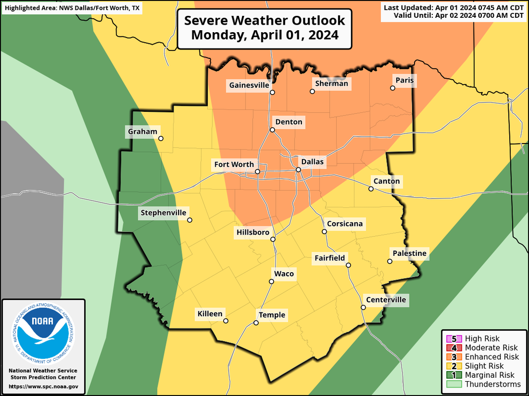 As I always say when I post the severe weather outlook, please do not get too caught up on the exact placement of these colors and zones. The storms ultimately do not know where the exact placement of these colors and will not behave as such. Just know that ALL of the region has a chance of seeing significant severe weather this afternoon and evening. TIMING - Storms could develop in North Texas as early as 2pm. The best chance of significant severe weather for this area will be from 3p to 9p today. This includes ALL of the metroplex. THREATS - ALL modes of severe weather will be possible. This will includes VERY large to perhaps GIANT sized hail in some instances, damaging wind gusts, and the possibility of several tornadoes. In fact, today is one of those days where a strong tornado or two (EF-2 or higher) is not out of the question. Due to the increased amount of rain and moisture in the atmosphere today, any tornado that forms may quickly become rain-wrapped and difficult to see. Do not wait to see or hear a tornado today. If a tornado warning is issued for your area, take cover immediately. WIND - Gradient winds (not pertinent to severe storms) could get as high as 40 mph today. A Wind Advisory is in effect for the metroplex and points to the east until 7pm. 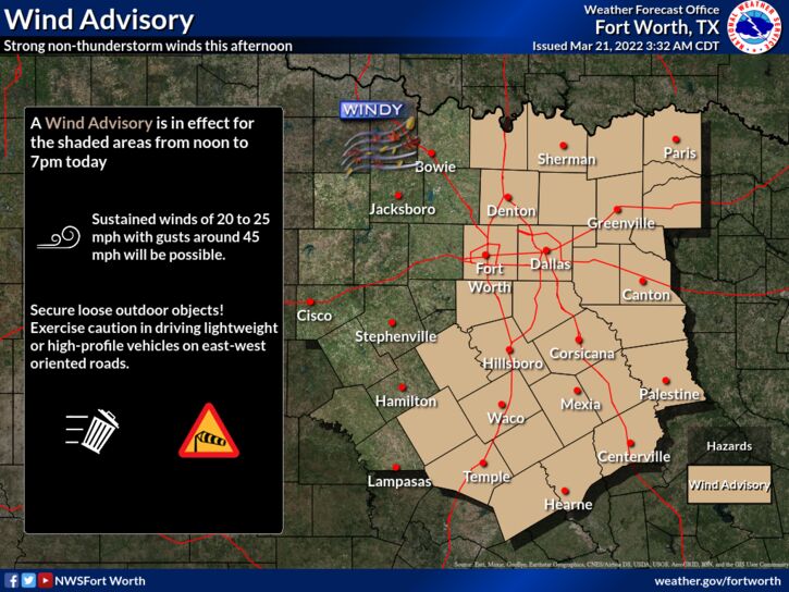 RAIN - About 1.5 - 2" is possible for the metroplex throughout the day, with higher amounts of 2-3" possible for places around Hunt County and points to the northeast. Although a widespread flash flooding event is not anticipated, localized flooding is a possibility.
BE PREPARED, NOT SCARED - Make sure you have a reliable way of receiving warnings this afternoon and evening. DO NOT RELY ON AN OUTDOOR WARNING SIREN. A NOAA Weather Radio should be in every home, and is something that you can easily find at any major retailer. On your phone, make sure you have WEA Alerts enabled. You can join our weather remind by texting @apexstorm to '81010', where we will be sending out updates if a warning gets issued for the metroplex or any of the coverage area. Know the safest place to go in your home, work, or school, and ensure that safe place has helmets for everyone. If you live in a mobile home, you can not stay there during a tornado. Know a site built structure you can evacuate to (business, community shelter, convenience store, etc.) at a moments notice. DO NOT BE ANXIOUS OR WORRIED! Events like this are very common in North Texas during our regular tornado season, which includes March, April, and May. Have a way of hearing warnings, have an emergency plan, and you will be fine. Although the odds of any one spot getting a tornado are very low, we must be prepared nonetheless. BE INFORMED: I know I have many first-time readers here. So I would like to say welcome and thank you for taking the time to read my products! I will have many more as we get closer to this event. If you would like frequent weather updates from me, please follow my Twitter @donowx. Please also like our Facebook page linked here. Also, please join our text messaging system to receive daily forecasts and updates by texting @apexstorm to '81010'. Or click the link. |
Archives
March 2023
Categories |
 RSS Feed
