
|
SUB-FREEZING START: Temperatures are in the 20s over the north-central part of the state this morning. We have lower 20s surrounding the metroplex. Burleson reports 22° at around 5:00am... Today will be very sunny with highs in the low to mid 50s. Clouds will increase tonight, as well as the warming trend. With ample sunshine we will be in the low 70s tomorrow and Friday. We will go ahead and mention the chance of a couple of showers on Friday as moisture levels rise as a result of a warm front lifting to the north. STRONG TO SEVERE STORMS POSSIBLE THIS WEEKEND: Another storm system will develop in the Plains this weekend, and will bring our first threat of severe weather for the season. Saturday will be very mild with highs in the low to mid 70s; thunderstorms are likely, but it won't rain all day. A deep surface low over northern Missouri will drag the dryline down into North Texas, causing a setup for severe thunderstorms late Saturday morning/Saturday afternoon. For now, it looks like the main window of the strongest storms for North Texas will come from 9:00 AM through 5:00 PM. The greatest threat of severe weather will most likely be confined to the Ark-La-Tex region, but the SPC has defined a broad zone of severe weather for Saturday for parts of the Central and Southern US. 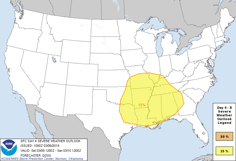 All modes of severe weather appear possible, including the potential for a few tornadoes. Rain amounts of generally 1/2 inch is expected, which will be less than sufficient for any flooding issues. More details will be ironed out as we get closer to the weekend. Sunday will be a bit cooler with clearing overnight... We will be in the mid 60s for most communities. NEXT WEEK: After a mostly dry workweek, rain chances return Monday and Tuesday with chances of widespread rain on Tuesday... See the Texas Weather Discussion Video for more details. 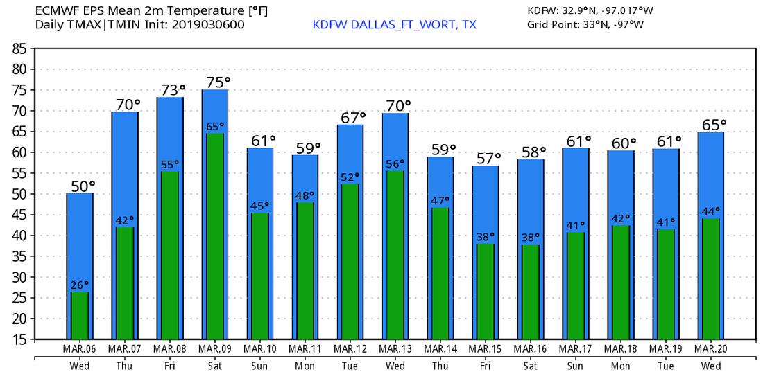 |
Archives
March 2023
Categories |
 RSS Feed
