
|
Like recent days, we start the day out in the 60s of all kinds, with some of the naturally cooler pockets in the 50-degree range. Better enjoy the last day (or two) of this for a while, because lows in the 70-degree range is likely as the upper-level ridge kicks in. Expect highs in the mid to upper 80s for today, but that will quickly change within a day or two. An increase in cloud coverage is possible later today as the remnant circulation of Irma continues to move to the northwest. We are just on the edge of drier air and we could see clouds as Irma progresses to the north-northwest. Tomorrow Through Friday - As a warming trend begins, we reach the low 90s by Wednesday, warming into the mid 90s by Thursday and Friday. We will still hang on to a couple of clouds throughout the day, but we should see abundant sunshine during the day on Thursday and Friday. The Weekend - Sunny, hot days and warm nights during the weekend with highs in the middle 90s and lows in the mid 70s, back to seasonal levels for this time of the year. Next Week - The majority of the week should be hot and dry as the upper ridge continues to hold. Highs will continue to be in the middle 90s. Irma? - Irma is now a post-tropical cyclone storm that is continuing to move to the northwest. All watches/warnings of this storm has been allowed to expire as this storm no longer poses a serious threat to life or property. Here is the final advisory from the National Hurricane Center. 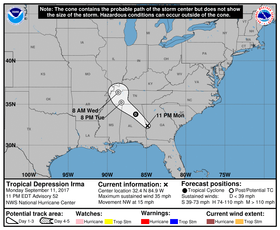 Jose - Jose currently has maximum sustained winds of 75 mph, and is expected to weaken to a tropical storm for a bit, before intensifying into a hurricane by Thursday, well to the north of Puerto Rico. The mean in the GFS ensemble continues to do a full loop in the Atlantic during the next five days. There is still uncertainty about this, and we will just have to worry about this with time. See the Texas Weather Discussion Video for more details. 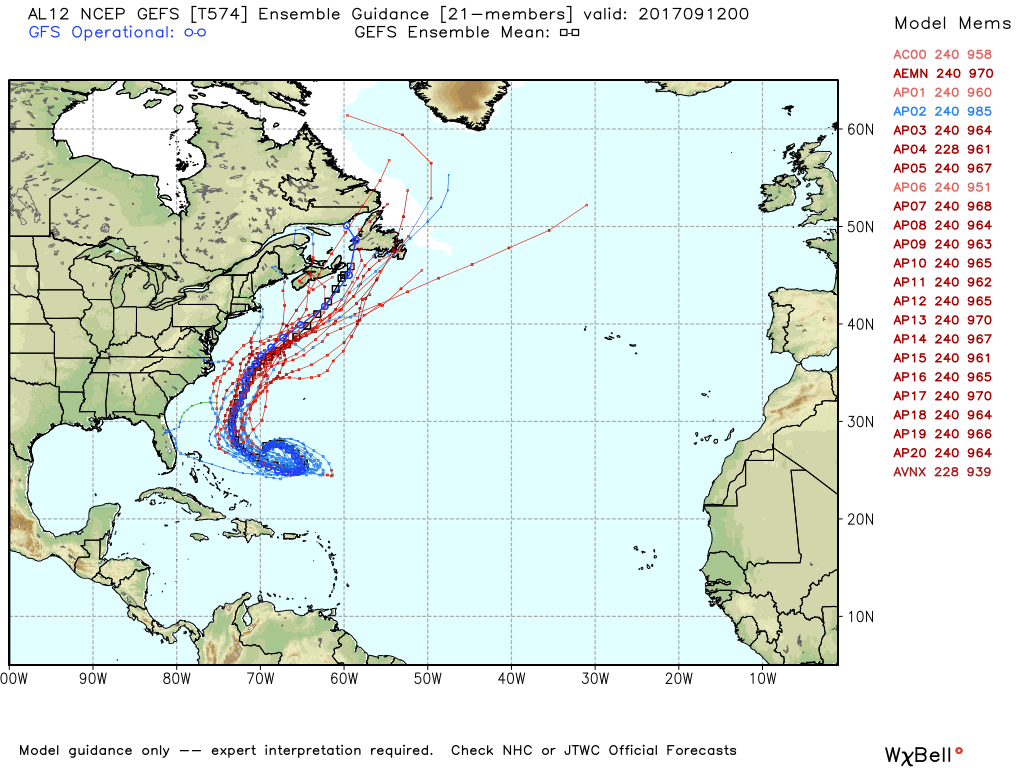 |
Archives
March 2023
Categories |
 RSS Feed
