
|
VERY WET WEATHER AHEAD - A storm system will organize to the west today over West Texas, and brings rain at times to the region this afternoon through Friday afternoon. Most of the morning and early afternoon hours will be dry with highs holding in the low 60s. While some parts of North Texas could see rain as early as 2PM, most of the rain will hold off until later this evening. The air will be stable for areas to the west of the DFW Metroplex. However, SPC maintains a "marginal risk" and "slight risk" of severe storms for areas to the north and east of the metroplex. A few storms here could produce strong, gusty winds, and there is a very low ended threat of a brief, isolated tornado. 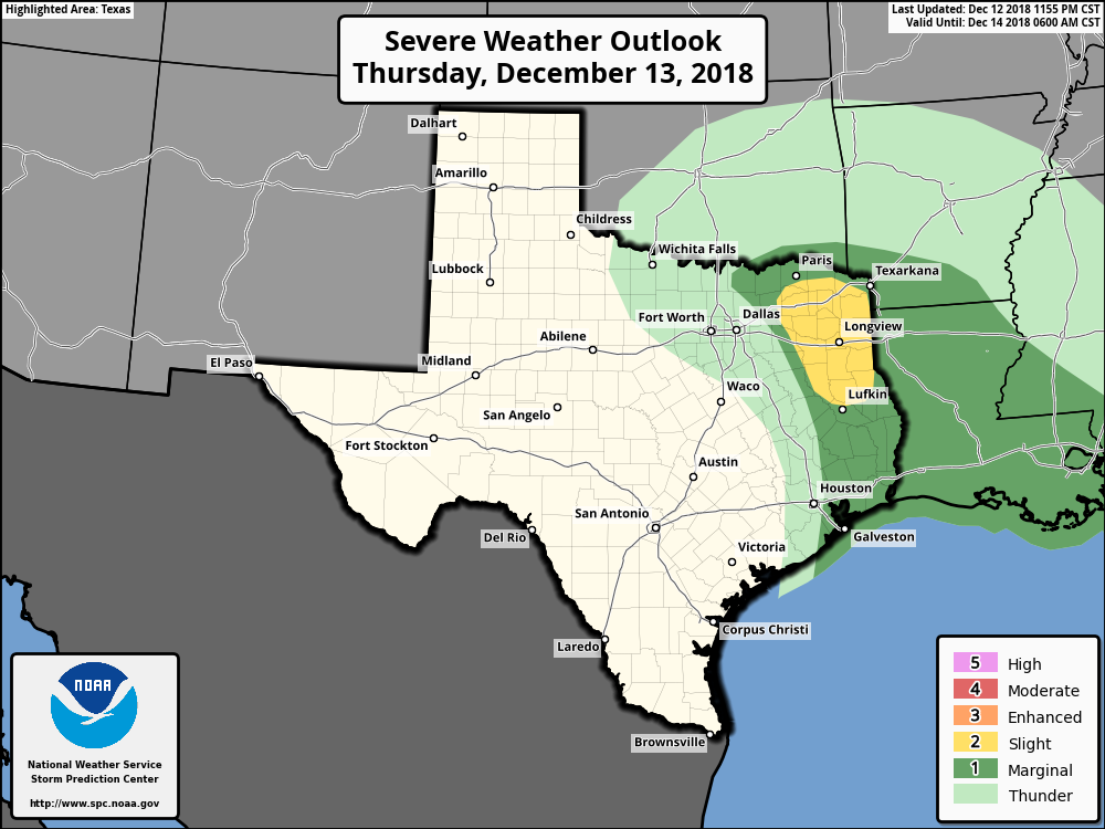 Tomorrow will be a wet morning with a cloudy sky and rain at times through the morning hours. Most of the wintery precipitation (if any) will be confined to areas to the west of the metroplex. No accumulations or significant travel issues are expected Friday morning. The high will hold in the upper 40s Friday. Rain totals from now through Friday afternoon will be anywhere from the 1/2 to 2 inch range, so no flooding issues is expected. THE WEEKEND - The storm system will lift to the northeast, away from North Texas. The weekend should be filled with mostly sunny skies with highs in the mid to upper 50s and low 60s around. Clouds should clear on Sunday. NEXT WEEK - It looks like a rather benign weather pattern sets up across Texas; we expect dry weather throughout the week with highs mostly in the upper 50s and lows in the mid to upper 40s. See the Texas Weather Discussion Video for more details. 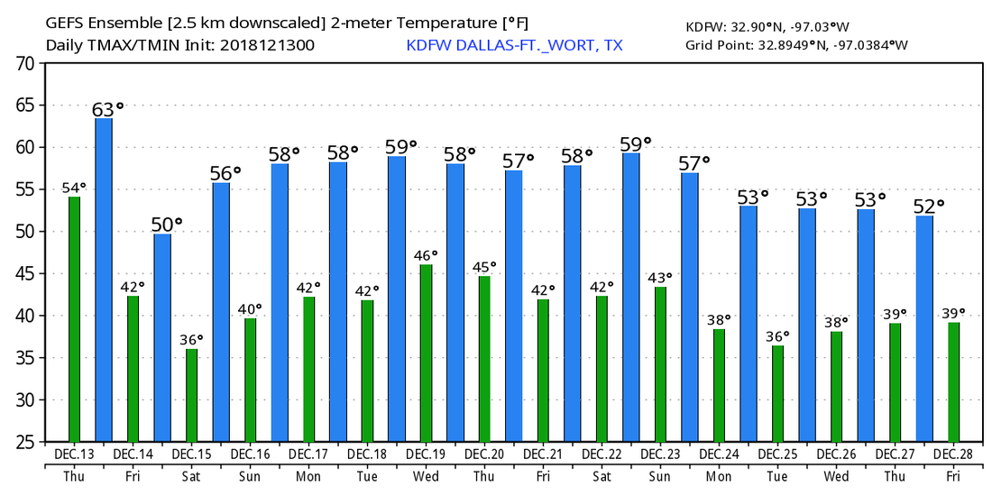 |
Archives
March 2023
Categories |
 RSS Feed
