
|
*no Texas Weather Discussion Video today* A very quiet morning across the Lone Star State. The sky is mostly clear with a few clouds about with showers and thunderstorms non-existent. Temperatures are in the upper 70s/low 80s this morning. We expect an increase in the temperature over the next few days as humidity values continue to stay very high. Each day will feature more sun than clouds with highs in the mid to upper 90s. FRIDAY AND THE WEEKEND - Not much change occurs on Friday and Saturday as we hold our hot weather pattern for those two days. Each day will be mostly sunny with highs in the upper 90 degree range. A cold front is due in here by Sunday afternoon, which will help with the temperature quite a bit. We will mention the chance of isolated showers and thunderstorms Sunday afternoon through Monday morning. This won't be a washout like what we saw last week, and highs will be in the mid 90s on Sunday. NEXT WEEK - The latest GFS runs suggest cooler, drier air filtering in the Plains next week, so we will accordingly mention a dry forecast for much of the upcoming week. A surface boundary moves east into North Texas on Friday, which will be another chance of showers and thunderstorms before the weekend begins. Highs each day will be in the low 90s. 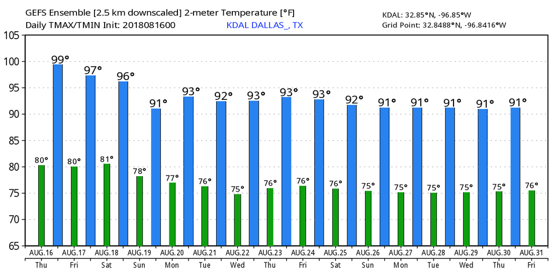 TROPIX - Subtropical Storm Ernesto is located over the Northern Atlantic with winds of only 40 mph. It will continue to move northeast, away from any land. Another wave is located east of the Windward Islands. The NHC is only giving a 10 percent chance of developing within the next two days. It is expected to continue to move east towards the Caribbean as an open wave as environmental conditions do not favor development. The rest of the Atlantic Basin remains quiet. 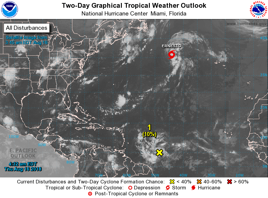 |
Archives
March 2023
Categories |
 RSS Feed
