
|
Outflow Boundary This Morning - Some areas around the DFW area saw a remarkable outflow boundary this morning, along that, pockets of brief heavy rain fell. 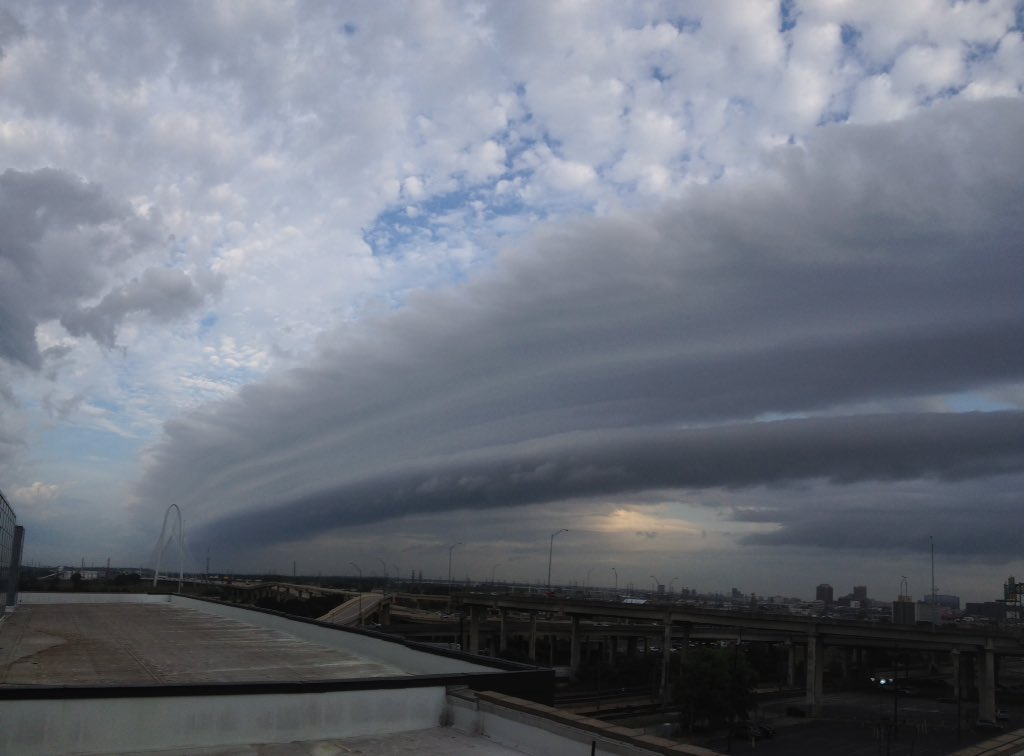 Aside from the rain, most locations are currently near the century mark again today, with DFW Airport just barely off reaching 100 degrees. In terms of climatology, we are below average on 100 degree days, and I would like to keep it that way. Chance for Severe Weather North of DFW - Showers and thunderstorms will be possible ahead of a stalling surface front. With that, the Storm Prediction Center currently has areas to the North of I-20 in the standard "slight" risk for severe weather. 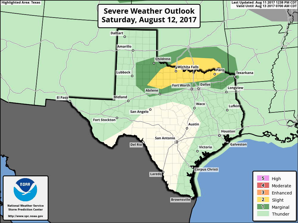 The main concerns right now are damaging straight-line winds, but a tornado or two can not be ruled out. Most of DFW may see some rain, but organized severe weather shouldn't be an issue for the greater metropolitan area. The risk for rain should also continue into Sunday morning as well into the overnight hours, but no severe weather is expected. Otherwise, expect partly to mostly cloudy skies with highs in the mid to upper 90s for the weekend. Next Week - The slight chance for showers and storms still exists as the surface front stalls just to the north of the TX/OK border early next week. The best chance of one spot getting wet is in the 20-30 percent bracket. Otherwise, expect mainly cloudy conditions with highs in the mid 90s again. MISD's First Day of School - As the front fizzles out, the temperatures should start to increase, and the cloud coverage should be limited. Most of us should continue to stay hot with highs in the mid to upper 90s, almost nearing the 100s, which is just about average for this time of the year. See the Texas Weather Outlook for more details. 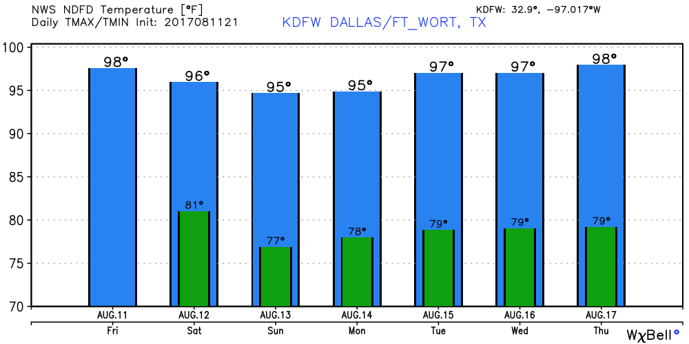 Tropics - There is one disturbance near Florida's east coast bringing heavy rain, but is not expected to develop anytime soon. Meanwhile, Invest 99L is continuing to show signs of development. As of now, it is in a much better environment for development as there is less shear involved. The NHC gives it a 50/50 chance of developing during the next five days. If it develops, it is expected to recurve into the Atlantic Basin, posing no threat to the U.S. 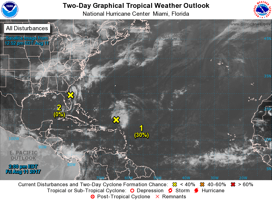 Next post will be Monday morning.
Have a great weekend. |
Archives
March 2023
Categories |
 RSS Feed
