|
STORMS THIS MORNING - To our northwest, a mini QLCS is moving through parts of northwestern Texas near Wichita Falls, where two tornado warnings have been posted just to the north of the city. To our north, some non-severe storms for our counties to our north continues to move eastward. It is also worth mentioning that a severe thunderstorm watch has been posted for our three northernmost counties (Grayson, Montague, Cooke) until 11AM this morning. Damaging winds and large hail can be expected with any severe storm that develops. Brief, isolated tornadoes can't be ruled out embedded in the main line.
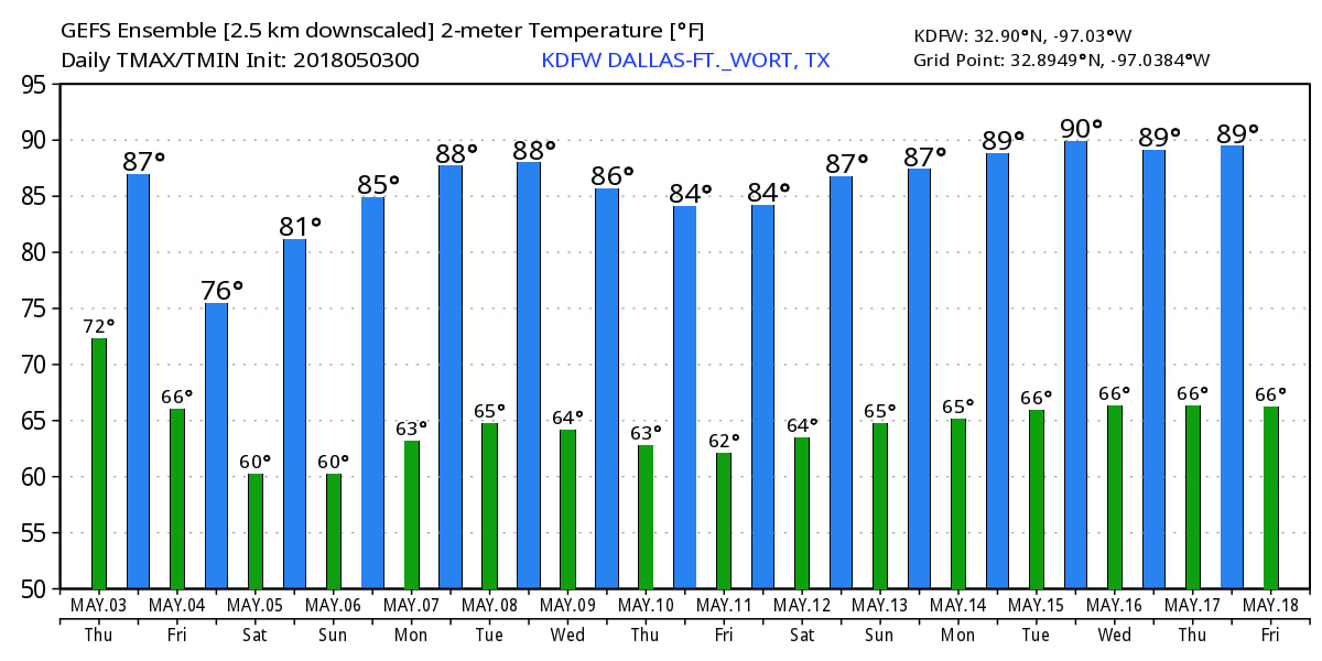
In North Texas, we are quiet now with temperatures in the low to mid 80s, but it may get noisy as we head into the early afternoon. A cluster of strong to severe storms is likely around 11AM into noon, tapering off during the evening hours. Be aware that all modes of severe weather will be possible, including the potential for gusty winds and large hail. The tornado potential is very low, but not zero. Be sure to stay tuned to the website and use our interactive radar for more details. We will still be wet tomorrow from the moving cold front, but there is no severe weather risk defined for North Texas after today. Rain is likely again during the morning and afternoon, and will taper off during the evening. Again, no severe weather is expected, just a classic rainy day is expected. Maybe some thunder, but that's really about it. Highs will be in the mid 70s as a result of that front. THE WEEKEND - Once the storm system lifts off to the east, we clear to pleasant conditions during the weekend. Highs should be in the upper 70s on Saturday, warming up to the mid 80s by Sunday. Each day will feature a sunny sky. NEXT WEEK - An upper ridge will build over the central part of the country, and that should keep us dry for most of the week. Highs should be in the mid 80s each day with a sunny sky. See the Texas Weather Discussion Video for more details. |
Archives
March 2023
Categories |


 RSS Feed
