
|
ANOTHER TYPICAL SUMMER DAY - We are forecasting highs closer to 100 degrees again today as a upper high continues to cover the southwestern U.S. We will continue to see more sun than clouds as we stay dry for much of the day. REST OF THE WEEK - Not much change. Expect much of the same weather for the next few days; hot, breezy, mostly sunny with a few clouds with highs in the triple-digits, closer to 100 degrees. THE WEEKEND -Expect another dry weekend ahead with much of the same weather throughout. Afternoon highs will be mostly at the 100 degree mark for most communities. Overnight lows will be in the upper 70s. NEXT WEEK - An upper-trough will cover parts of the midwestern states which will allow a surface front to move south through Texas early Monday morning. This will open the door for cooler temperatures, and maybe a chance of scattered showers and thunderstorms on Monday. The best chance of any one spot getting wet will be in the 40-50 percent range early Monday morning into the afternoon. Highs will be in the low to mid 90s for the rest of the week, a 20+ degree difference from this weekend. The Climate Prediction Center continues to forecast below average temperatures for North Texas during the July 30 - August 3 forecast period. See the Texas Weather Discussion Video for more details. 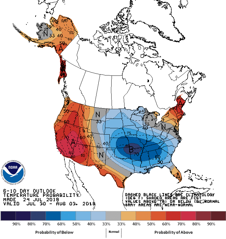 TROPIX - Tropical Cyclone Formation is not expected for the rest of this week through the weekend.
|
Archives
March 2023
Categories |
 RSS Feed
