
|
After a nice day today, things change heading into your weekend. Let's get into detail. As a cold front approaches tomorrow between 5-9pm, showers and storms are expected to fire up. Storms will have a decent shot of being severe with all modes of severe weather possible. The best severe risk is east of I/35. More isolated activity farther west, but still a threat of severe weather there. We turn sharply colder tomorrow night, before something really rare begins to occur. Yes indeed, some ice could make a comeback into the forecast, IN APRIL! Some of the latest guidance has us falling to near freezing Saturday morning, with some left over lift and moisture. 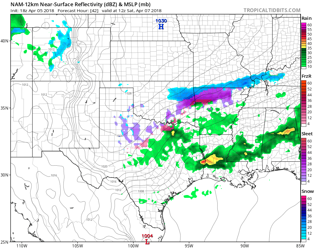 Some light rain may mix with light sleet or freezing rain across parts of the area. The more favored area will be northwest of DFW, but I cannot completely rule out some very light winter weather. Either way, no accumulations are expected at this time with maybe a slick spot northwest of the metroplex.
The NAM, which is more accurate with shallow air masses, has us only rebounding to the 40s Saturday afternoon. I'll have a high of 50° for now, but will adjust as needed. We dry out late Saturday and we quickly warm up Sunday. We start in the upper 30s, but reach the 70s by afternoon. Texas, stop drinking your beer! We remain warm anf mainly dry next week, with possibly some storms returning later in the week. Jonathan Williams Weather Forecaster Storm Specialist NWS/NOAA Ambassador |
Archives
March 2023
Categories |
 RSS Feed
