
|
STILL HOT: We are not entirely doomed today, however, as only a couple of spots are reporting low 80s this morning. Most are reporting mid to upper 70s, which is very seasonal for this time of the year. We will continue to have another hot, dry day with highs in the upper 90s once again. A few spots may reach the triple digit mark again this afternoon. THE WEEKEND: An early August front will bring in cooler temperatures for the weekend and early next week followed by a chance of showers and thunderstorms, especially during the evening hours on Saturday. However, I believe that there will be a hidden chance of isolated showers for most of the afternoon hours on Saturday. Some of the storms could be on the strong side, as the SPC has outlined "marginal risk" (level 1/5) of severe storms for much of the North-Central Texas region for Saturday evening/early Sunday morning. 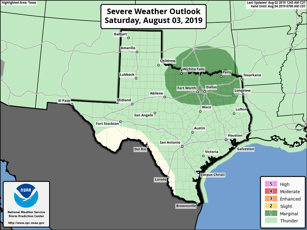 The best chance to look for isolated showers and thunderstorms will be during the evening hours on Saturday. Some of the more scattered/widespread rain will happen during the pre-dawn hours Sunday. Some rain will continue into Sunday afternoon, but we should be mostly dry by 3PM. Highs for the weekend will be in the low 90s with a mix of sun and clouds throughout the day. NEXT WEEK: The first two days will feature highs below mid 90s, which is below our seasonal averages. We transition back to mostly sunny skies, hot and humid conditions, and highs near the 100 degree mark by mid-week. See the Texas Weather Discussion Video for more details.  TROPICS: There is an open wave in the southern Atlantic that only has a 40% chance of becoming a tropical depression within the next five days. Upper level winds will not favor any further development. The rest of the Atlantic Basin remains quiet.
|
Archives
April 2024
Categories |
 RSS Feed