
|
RADAR CHECK - A couple of showers has formed in north Texas and parts of southern Oklahoma, as expected. We will see them move to the east at daybreak this morning. Today will be overall cloudy & warm this afternoon. Most places will reach the mid 80s this afternoon. We will maintain the risk for scattered showers during the afternoon, but severe storms will arrive this evening. The Storm Prediction Center maintains a "enhanced risk" of severe storms from Longview extending into Mississippi. The "slight" risk extends into the DFW metro, the I-35 corridor and points to the east. 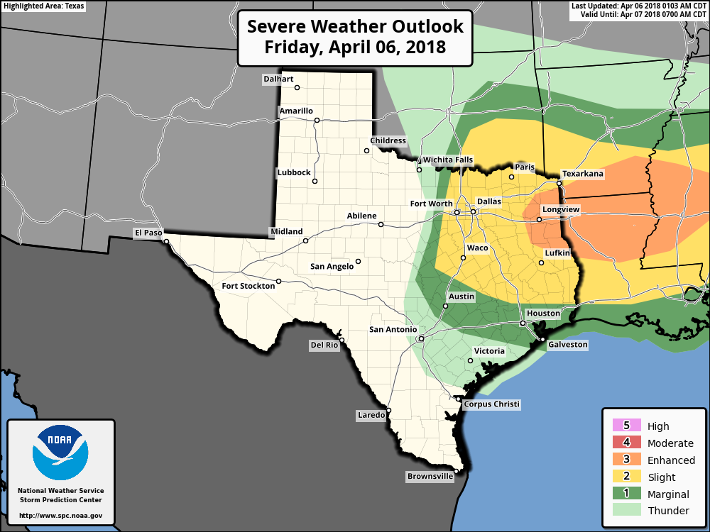 While the CAPE values will be the highest its been all season, other factors come into play, such as the placement of the main convection, and other parameters that really determine the severe risk. By the afternoon hours, the cap will already have weakened, which will allow severe thunderstorms along the cold front to freely move through the region. The good news is, most of the severe parameters remain to the southeast of the metro (southeast Texas), but, we could see some severe storms that could pack a punch in a highly unstable airmass. TIMING - The window for strong to severe storms in North and central Texas will be from 6PM this evening to 12AM overnight. THREATS - The main issue with storms in the metroplex will be large hail. Some of the strongest storms could produce hail more than 2” in diameter. An isolated tornado or two can’t be ruled out with some weak shear in the region. The damaging wind threat will be maximized in east Texas extending to the Mississippi Valley. RAIN - Rain amounts will likely be in the 1/2 - 1” range for much of the region, not sufficient enough to cause flooding concerns. tl;dr - The overall severe weather risk remains very conditional for north Texas. We will keep our eyes on the radar this evening. The main threat is not in North Texas, but you always need to expect the unexpected when it comes to these risks. VERY COLD DAY TOMORROW - After the storms clear the area Friday night, cold air advection will follow, which will keep us cloudy and very cold for most of the day on Saturday. The NAM also has us in the mid 30s for most of the afternoon as well... 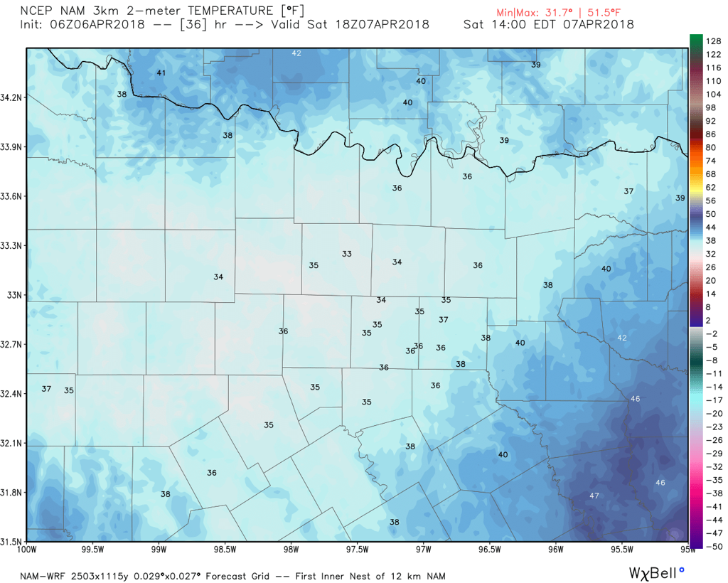 The same model also brings a chance of very light freezing rain for some places in the region. With freezing temperatures in some spots, we will likely see that happen for our northern counties. It will not feel like spring at all in the Deep South. In fact, these temperatures will be about 30 degrees below average for early April. It be a raw, cold day across the state. The sky will clear to sunny skies on Sunday with highs in the mid to upper 70s. NEXT WEEK - We could see some widely scattered showers and thunderstorms during the day on Monday, and next week looks overall dry with highs in the 70 degree range. See the Texas Weather Discussion Video for more details. 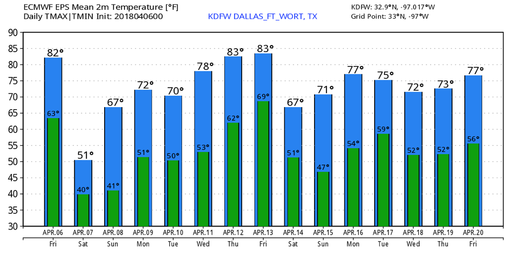 |
Archives
April 2024
Categories |
 RSS Feed