
|
Radar Check - Scattered showers and storms are about in North Texas, which breaks the dry phase in DFW that has been in place for a while now. 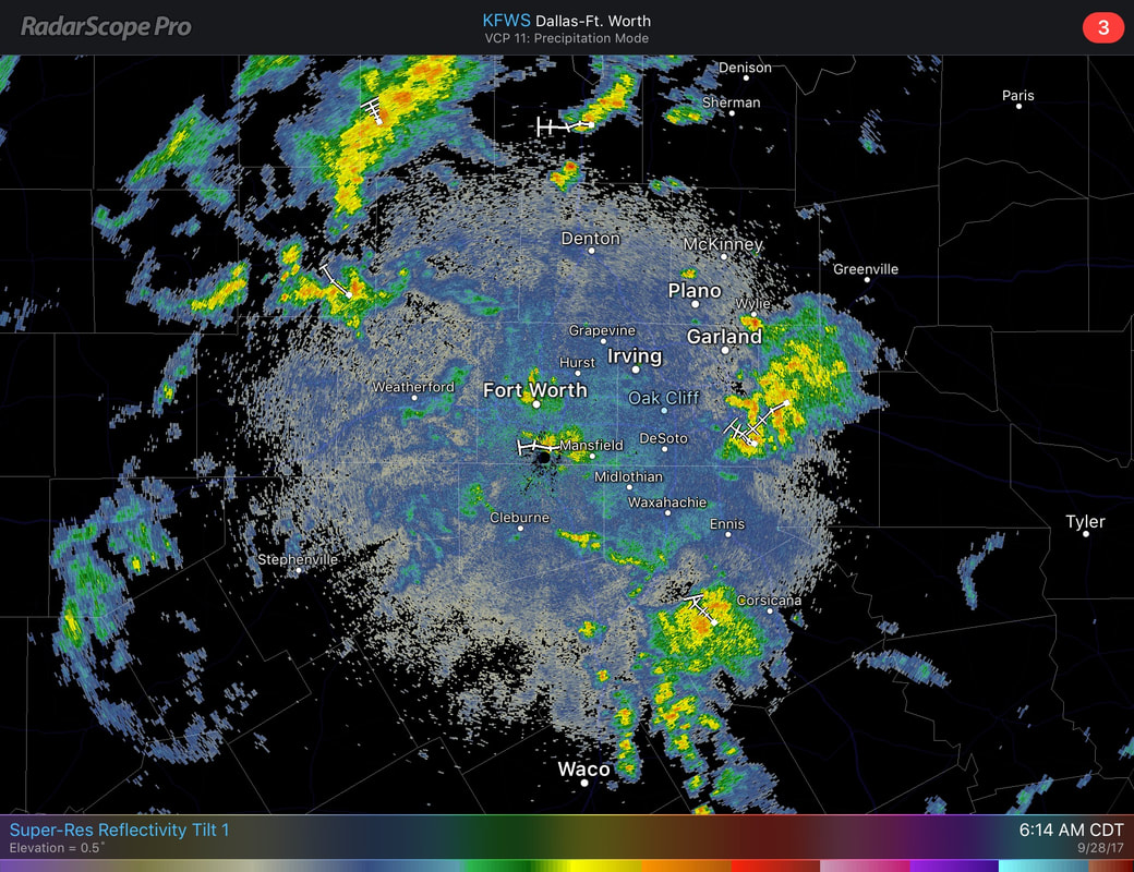 We can't tell you specifically where it will rain due to the scattered nature of the storms, but most of the storms should taper off after noon today. The sky will remain mostly cloudy for today and tomorrow with highs in the 80-83 degree range with lows in the upper 60s. The Weekend - Cloud coverage will lighten Saturday and Sunday with highs in the mid 80s with lows in the mid 60s with some of the naturally cooler pockets in the 70 degree range. Next Week - The pattern starts to look dry again, although, the GFS continues to mention some moisture returning around us. If that continues to be the case, then we might mention a chance of an isolated shower or storm on Wednesday. Otherwise, very little to no rainfall next week with highs in the upper 80s. 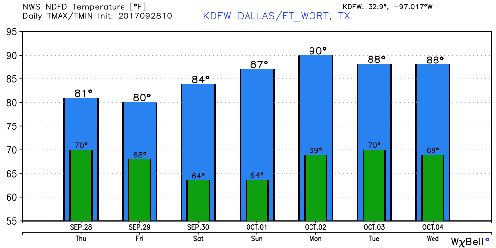 Tropics - Tropical Storm Maria and Hurricane Lee are both in the Atlantic, moving east-northeast away from land. A disturbance near Cuba has a 50/50 chance of developing during the next five days, but either way, that is expected to bring heavy rain to the Florida Peninsula in coming days. Global Models continue to hint at some additional development in the Northern Carribean and Gulf of Mexico during the next week, which is just an idea in fruition that we can't be specific on this early in the game. See the Texas Weather Discussion Video for more details. 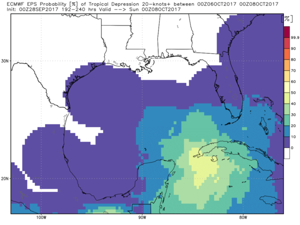 |
Archives
March 2023
Categories |
 RSS Feed
