
|
ABNORMAL MOISTURE LEVELS CONTINUE - For the past few days, robust moisture levels have been in place over much of North and Central Texas as well as East Texas, and most of the showers and thunderstorms over the state have in those regions, respectively. We will continue to forecast scattered afternoon showers and thunderstorms with daytime heating region-wide later today. The best chance of any one spot getting wet is in the 30/40 percent range, and the high this afternoon will be in the mid 90s. FRIDAY THROUGH THE WEEKEND - A surface front will move southward from the north, but should dissipate before reaching North Texas. With moisture levels starting to come down, we will roll with a persistent forecast for Friday and through the weekend with mostly sunny skies and humid days with highs in the upper 90s to low 100s. An isolated shower or thunderstorm in a place or two is not ruled out. NEXT WEEK - Not much change. As we roll with a persistent forecast, our routine summer time pattern continues with highs in the upper 90s to low 100s. See the Texas Weather Discussion Video for more details. 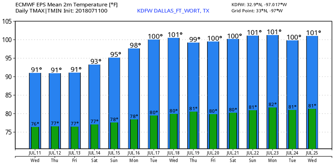 CHRIS FINALLY MOVING - Hurricane Chris peaked in intensity earlier this morning. It will gradually weaken later this week through the weekend as it moves over cooler waters. By Friday, it should become post-tropical as it moves away from the Northern Atlantic. 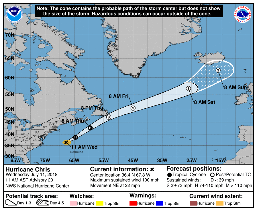 THE GHOST OF BERYL - The remnants of Beryl are over the Bahamas at this point. The NHC rolls with a 50/50 chance of redevelopment within the next five days. One way or another, it should move to the northeast, following Chris with no threat to land.
|
Archives
March 2023
Categories |
 RSS Feed
