
|
Dry Airmass Through Saturday Evening - Temperatures are mostly in the mid to upper 30s this morning across much of North Texas, some of the colder spots in the western counties are in the upper 20s. Today will be another one of those dry days with highs in the mid 50s, which is actually below seasonal averages for mid-December. Expect a great supply of sunshine today. The Weekend - Saturday morning will still be chilly with most communities starting in the low 40s, then we should warm to the low 60s with abundant sunshine during the afternoon hours. Clouds will start to move in Saturday morning, then rain should begin during the late Saturday night hours or near midnight as a shortwave trough approaches from the west. Any lingering showers will most likely be Sunday morning, but we should be clear for most of the day, and highs should be in the mid 60s. Next Week - Next week looks generally dry with cool nights and pleasant days; highs should average to about the mid 60s with lows mostly in the low 40s. The strongest cold front of the season moves in Thursday evening, which should drop temperatures considerably and maybe even create chances for winter precipitation during the weekend. Still way too early for a specific forecast on that, but just an idea. As we get closer, we dive even more into model madness with this event. 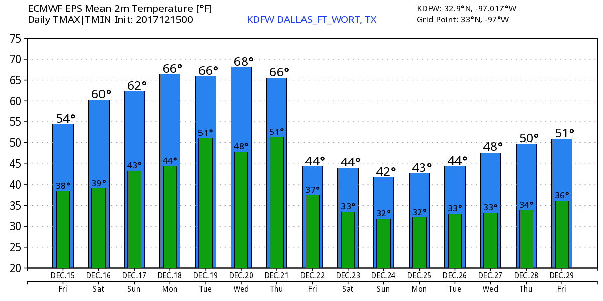 Christmas - Still way too early for a specific forecast, but confidence is increasing that we could see some snow before Christmas. A White Christmas in some spots is still not out of the question though, but we dive more into the model madness the closer we get to the event. We will have the first real look at the situation this Monday. See the Texas Weather Discussion Video for more details. 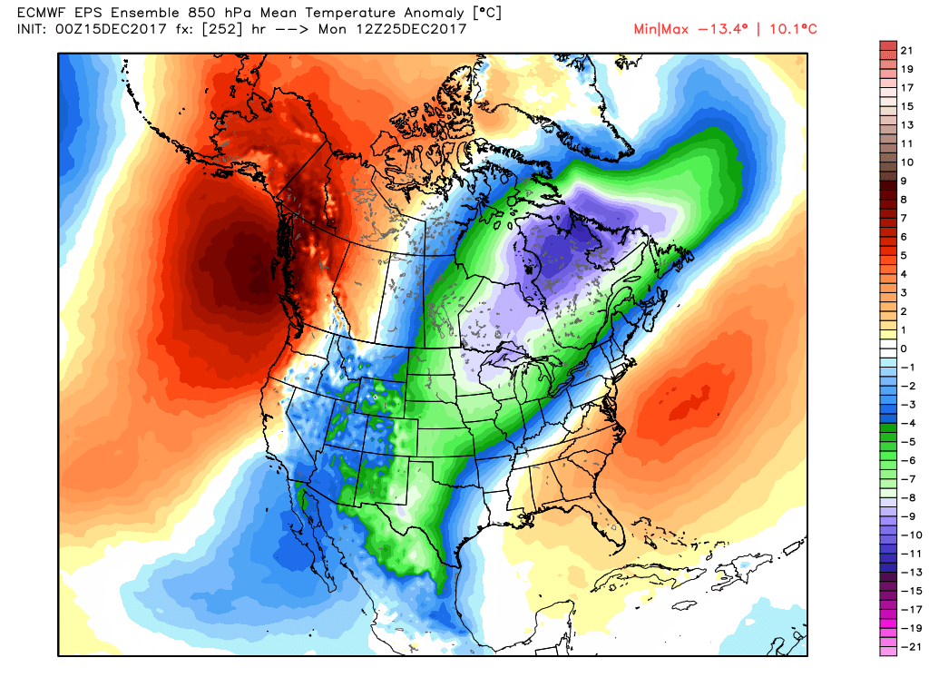 |
Archives
March 2023
Categories |
 RSS Feed
