
|
CHILLY START - You will need a jacket as you head to work or school this morning. Temperatures this morning are in the mid 40s across the region with light and variable winds. A chilly start will give off to a pleasant day ahead with lots of sunshine. Highs should be in the mid 60s. Tomorrow will be very similar to today; chilly mornings, pleasant days. We start the day in the mid 40s before warming up to the mid to upper 70s during the afternoon. FRIDAY AND THE WEEKEND - A cold front comes through during the day on Friday, and we will need to mention the chance of widely scattered showers and thunderstorms during the day. That activity will progress overnight, and we will likely see our main event Friday night/early Saturday morning. Some of those storms could be on the strong to severe side with hail and gusty winds possible. We do note that the SPC has defined the standard "slight" risk for much of North and Central Texas and points to the east. 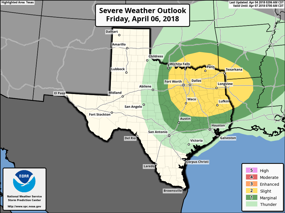 It's still a bit too early to pinpoint exact timing of the storms, or the magnitude of the threat. We will have a good look at this risk later today or tomorrow morning. Highs should be low 80s on Friday. Saturday morning will be quite chilly due to a strong cold front moving through during the day on Friday. Some places could see lows in the mid to upper 30s with a light freeze possible for counties along the Red River. Once the rain clears in the morning, we will still only be in the mid 50s. The sun returns Sunday, and we should be back to the mid 70s. NEXT WEEK - Most of the week will feature cool nights and pleasant days with lots of sunshine. Highs will be in the mid 70s, very average temperatures going into mid April. See the Texas Weather Discussion Video for more details. 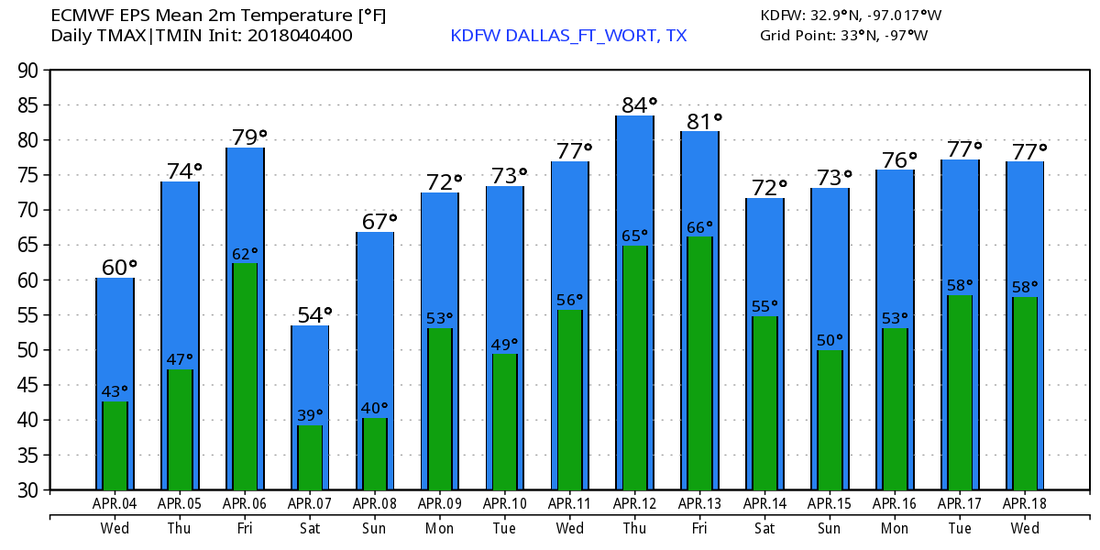 |
Archives
March 2023
Categories |
 RSS Feed
