
|
MOSTLY SUNNY - Once again a dry airmass encompasses much of the North Texas region this morning, and with breezy and humid conditions again, we expect a mostly sunny day with highs in the century range. Same deal on Tuesday; Hot, humid, mostly sunny with highs i the 100 degree range. WEDNESDAY THROUGH THE WEEKEND - A weak upper disturbance noted in the northern Gulf will emerge onto land today, which could help pull some moisture from the east to kick off a few isolated showers and thunderstorms during the latter half of the week as that impulse moves westward with time. Keep in mind that not everyone will see rain, and the best chance of any one spot getting wet is in the 20/30 percent range. Otherwise, expect a mix of clouds and sun with highs in the mid 90s. This will be the case through the weekend as the impulse moves more to the west. NEXT WEEK - The typical storm track stays way to the north (near the Canadian border). And with that, we will roll with a persistent forecast; hot, humid, abundant sunshine with highs in the mid to upper 90s. See the Texas Weather Discussion Video for more details. 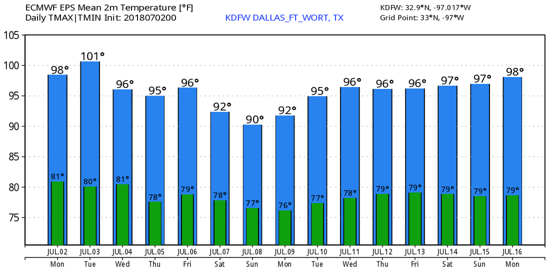 TROPICS - As a result of the Saharan Dust from Africa, the deep Atlantic Basin remain quiet, and no new tropical cyclones are expected within the next week.
|
Archives
March 2023
Categories |
 RSS Feed
