
|
VERY PLEASANT AFTERNOON: Despite mostly cloudy skies, temperatures are mostly in the 60 degree range across North-Central Texas this late afternoon. We do note the severe thunderstorm warning polygon in Cherokee counties in East Texas. Clouds will continue to hang out overnight.  TOMORROW THROUGH FRIDAY - Although a cold front will come through early morning Thursday, the weather shouldn't change too much over the next few days; we expect mostly cloudy skies with showers still very few and far between. The high will warm to the low 70s as the streak of mild temperatures continues. Our best chances of scattered showers come Wednesday evening overnight through early Thursday morning. Then, chances dwindle down Thursday afternoon. The sun will come out Friday, but we will still be partly cloudy with highs in the low 70s. THE WEEKEND: Global models are currently split on the potential on a weekend forecast solution, so there is still lots of uncertainty. The one thing we are very certain about is the cold front surging through late Friday evening through early Saturday morning. This will bring another fresh batch of clouds to the region with colder temperatures. Highs will be in the mid 40s on Saturday. Sunday is where models begin to crash. Some are more aggressive in terms of winter weather, and others only indicate light rain or even dry conditions. To keep things really simple with these blogs (as we always try to do), we simply don't know what's going to happen yet. However, if we see any ice, sleet, or snow, there is a high chance the precipitation would stick, given the arctic front coming through. To see the best of both worlds, we will stick with scattered showers with some chance of a wintery mix during afternoon/evening. Once again, this is five days out, and a lot of things can and will change. Highs will only reach the low 40s, but we could be colder... NEXT WEEK: We have been trending towards dry conditions as we start the week. However, there is a great possibility that we will stay below freezing on Monday, then we warm slowly through the rest of the week, eventually ending up in the low 50s by Friday. Cold air stays in place for next week with temperatures below average for early March. See the Texas Weather Discussion Video for more details. 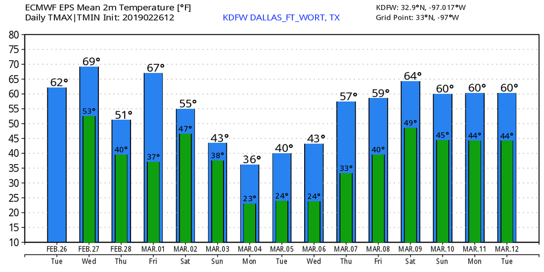 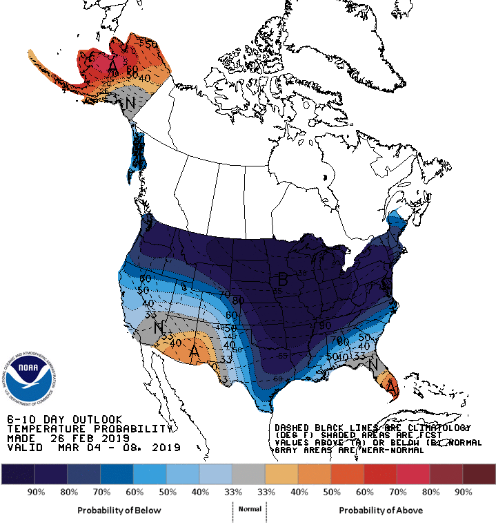 |
Archives
March 2023
Categories |
 RSS Feed
