
|
FAIRLY COOL START - Temperatures are currently in the mid to upper 50s across the North Texas area... We will warm to the low 80s today with sunshine in full force, which is above our average high of 74° for late October. Not much change in the forecast for tomorrow either; mostly sunny, very warm afternoon with highs near 80°. HALLOWEEN - A cold front will move through during the early morning hours on Wednesday, which means cooler temperatures and a good chance of scattered/numerous showers and thunderstorms throughout the day. The good news is rain may begin to dissipate before 7P, which is the perfect time for trick-or-treating though the streets will likely be quite wet. Highs will be in the upper 60s Wednesday with mostly cloudy skies. REST OF THE WEEK THROUGH THE WEEKEND - A high pressure builds over West Texas on Thursday, and we subsequently stay dry for the rest of the work week with mostly sunny skies. Highs will be in the mid 60s for Thursday and Friday, closer to 70° on Friday, absolutely perfect weather for high school football games. The weekend will be no exception to more sunshine and nice, fall weather. Highs will be in the upper 60s both days with mostly sunny skies. Clouds may increase on Sunday. NEXT WEEK - The beginning of the first full week of November looks dry with abundant sunshine. Highs will stay in the upper 60s to low 70s. See the Texas Weather Discussion Video for more details. 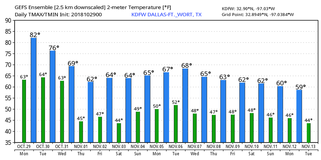 TROPICS - Hurricane Oscar is in the Central Atlantic with maximum sustained winds of 80 mph. It may try to intensify to a Category Two hurricane before it becomes post-tropical in the Northern Atlantic Thursday morning. No threat to any land areas. The rest of the Atlantic Basin remains very quiet. The 2018 Atlantic Hurricane Season officially ends November 31. 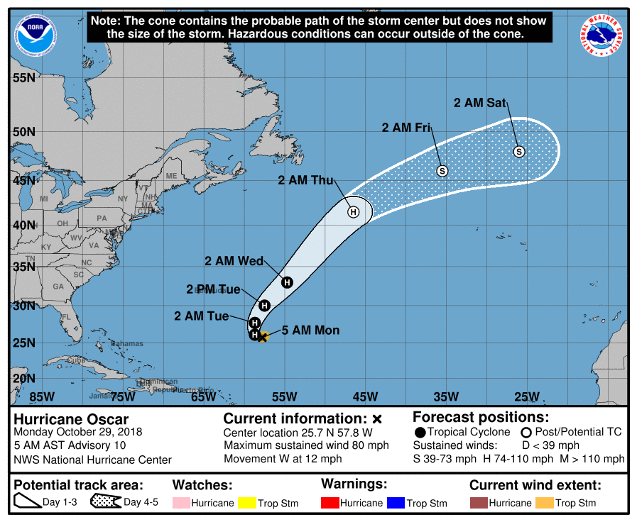 |
Archives
March 2023
Categories |
 RSS Feed
