
|
MICHAEL NOW A CATEGORY FOUR HURRICANE - Overnight, Michael strengthened into an extremely dangerous, life-threatening category four hurricane in the Gulf of Mexico now with sustained winds of 140 mph. This will make landfall near Panama City Beach today. 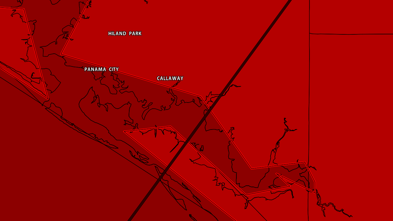 A HURRICANE WARNING IS IN EFFECT FOR...
* ALABAMA/FLORIDA BORDER TO SUWANNEE RIVER FLORIDA A TROPICAL STORM WARNING IS IN EFFECT FOR... * ALABAMA/FLORIDA BORDER TO THE MISSISSIPPI/ALABAMA BORDER * SUWANEE RIVER FLORIDA TO CHASSAHOWITZKA FLORIDA * NORTH OF FERNANDINA BEACH FLORIDA TO SURF CITY NORTH CAROLINA A STORM SURGE WARNING IS IN EFFECT FOR... * OKALOOSA/WALTON COUNTY LINE FLORIDA TO ANCLOTE RIVER FLORIDA. DANGEROUS STORM SURGE AND TIDE WILL CAUSE TYPICALLY DRY AREAS TO BE FLOODED BY THE OCEAN WATERS. THE WATER WILL HAVE THE POTENTIAL TO REACH THE FOLLOW HEIGHTS ABOVE GROUND AT PEAK SURGE DURING THE HIGH TIDE... TYNDALL AFL TO KEATON BEACH - 9-13FT OKALOOSA/WALTON COUNTY LINE TO TYNALL AFB - 6-9FT KEATON BEACH TO CEDAR KEY - 6-9FT CEDAR KEY TO CHASSAHOWITZKA - 4-6FT CHASSAHOWITZKA TO ANNA MARIA ISLAND - 2-4FT Rain amounts of up to five to six inches are possible across the Florida Panhandle through southern Georgia and Northern North Carolina. This is a progressive system that will not stall like Florence. A few tornadoes are possible today across North Florida and southern Georgia and areas on the right side of the center of Michael. Sunshine will return to the Gulf Coast tomorrow, which should be perfect for the National Shrimp Festival in Gulf Shores this weekend with sunny, pleasant days and fair nights. REST OF THE WEEK FOR NORTH TEXAS - An upper high is located over the Texas Panhandle, which means we will experience cool, crisp days for a long time. Highs will be in the mid 70s and morning lows will be in the mid 50s with mostly sunny skies. THE WEEKEND - The remnants of Sergio in the pacific will be moving to the northeast towards North Texas, and we should be able to pick up a bit of moisture from the system. We will mention the chance of scattered showers and thunderstorms Saturday evening through early Sunday morning. A good chunk of both days will be mostly dry with highs in the mid 70s on Saturday, falling into the middle 60s on Sunday as the cold front moves through. NEXT WEEK - We truly welcome in fall weather for the next several days with cool, crisp afternoons and fair, cold nights. Lows will be mid 40s to mid 50s, and the sky will be partly to mostly cloudy with highs in low to mid 60s for most of the week. See the Texas Weather Discussion Video for more details. |
Archives
March 2023
Categories |
 RSS Feed
