
|
WARM JUNE WEATHER: We are forecasting a high in the upper 80s to low 90s for most North Texas communities today. The sky will be partly cloudy, and the best chance of isolated showers and storms this afternoon will lie over the northeast corner of the region. The average high for Dallas/Fort-Worth on June second is 88. The ridge will continue to build through the rest of the week, and we will bring rising temperatures to the forecast again. We will remain mostly dry with a mix of sun and clouds each day. We will gradually get hotter with afternoon highs ranging from the low to mid 90s with overnight lows generally in the middle 70s. THE WEEKEND: Not much change. Typical weather for early June should continue with warm, humid conditions. There could be a slight uptick in moisture levels with a slight chance of scattered showers and thunderstorms on Sunday, depending on the track of the tropical system in the Gulf of Mexico. Mix of sun and clouds with highs in the 90s. NEXT WEEK: Again, our weather will be largely dependent on the tropical situation. If the system moves into Louisiana, or Southeast Texas (as it appears now) and stays to the east, the week will be warm with a mix of sun and clouds daily with highs in the 90s. Otherwise, expect an uptick of moisture with a chance of scattered showers and thunderstorms for at least the beginning of the week. 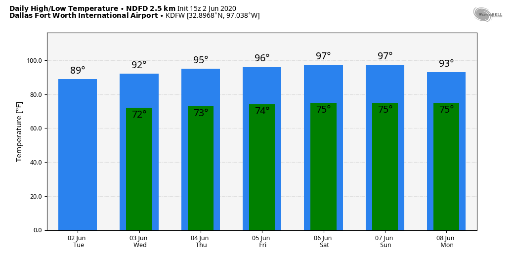 TROPICAL DEPRESSION THREE: The third tropical depression this year developed late yesterday over the Bay of Campeche in the far Southwest Gulf of Mexico. It is expected to become Tropical Storm Cristobal today, and it will move very little, if, at all, over the next 48 hours. The system will then move northward this weekend, and the NHC forecasts the center to be over the Gulf of Mexico by Saturday night. 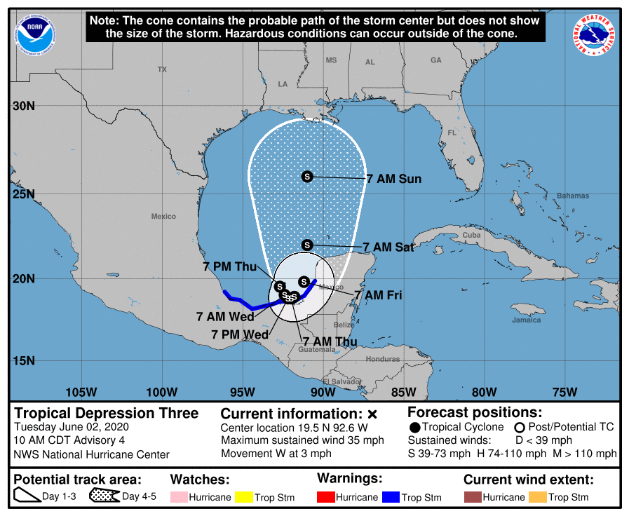 From there, higher landfall probabilities lie over the upper Texas and western Louisiana coast Sunday night or Monday, as a possible hurricane. Of course, there is no skill in a specific forecast in terms of specific landfall point or intensity of the system. Typically, the biggest threat from early season tropical system come from heavy rain and flooding. 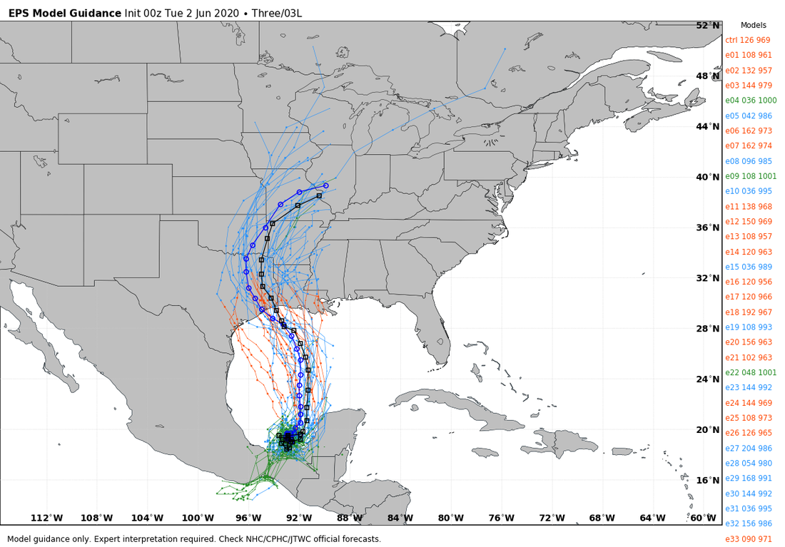 ON THIS DAY IN 1998: A tornado touched down in Frostburg, Maryland on June 2, 1998 at 9:45 PM. This was a part of a killer tornado outbreak of tornadoes that moved southeast from Pennsylvania. The storm first entered Garrett county, impacting the town of Finzel. From there, it moved up and over Big Savage Mountain in Allegany county and ripped through the northern portion of Frostburg, where it reached peak intensity as it crossed the ridge. Winds were estimated between 210 and 250 mph (which was considered F4 criteria on the Fujita Tornado Damage Scale). This was the first tornado to be officially rated an "F4" in the State of Maryland.
Look for the next blog update by noon tomorrow. Enjoy the day! Donovan Neal Owner/Founder - ApexStorm |
Archives
March 2023
Categories |
 RSS Feed
