
|
Much of the North Texas region appears sunny this morning, although clouds from the disturbance in the Texas Coast is affecting much of North and Central Texas. Broad ridging remained in place yesterday afternoon and this morning, which precluded a more widespread rain event. WIth broad ridging still in place today, it appears very likely that any showers and thunderstorms will remain very spotty and limited in coverage today. Highs should be in the upper 80s to low 90s today. The broad ridge that is currently in place for much of the south-central US will be weakened by the approach of a surface front from the northwest on Wednesday. That front will slowly move towards the northern part of Texas as we get towards Friday and the weekend as a closed low weakens the area of high pressure over the southeast US. As we go down towards the surface, an area of high pressure builds over the four corners region during the latter half of the week, which will do a good job of pushing the surface front down into Texas. Although Precipitable Water values will be in the 2-2.5 inch category, the eastern side of the coverage area will have the best chances of rain as we are sandwiched in between drier air and a moist airmass. We will still mention the chance of scattered showers and thunderstorms during the day today and tomorrow as coverage decreases Thursday and Friday. 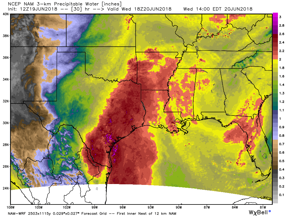 One good thing about all of the cloud cover that we probably don't notice is that it does a good job of keeping highs just out of the 90s today and tomorrow and maybe Thursday. But, we probably won't notice that as a result of the higher humidity levels. Looking out into the Atlantic Basin, it remains quiet with of course the exception of the area of disturbed weather near Corpus Christi. Areas surrounding that and near Houston will see lots of rainfall over the next seven days with amounts of over 7 to 10 inches. For North Texas, amounts will be very limited and spotty due to the scattered nature of the showers and thunderstorms. Amounts of around 0.5 to 1 inch can be expected. 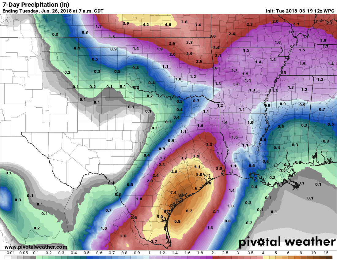 From the weekend through the early half of next week, the surface front lifts back to the north after it pulls down a drier airmass for Texas. Highs will go back to the mid 90s with a mix of sun and clouds. Taking a sneak peak past ten days, the GFS shows normal heights for North Texas closing the month of June, which also indicates a little shortwave trough in the four corners region which could open the door for scattered showers during that time period. We turn dry for early July, with a substantial ridge and heat bubble building over the eastern half of the US. I don't think we will be too hot as a result of normal heights here in North Texas. So that's really about it. Regardless of rain or cloud cover, make sure you are still practicing heat safety wherever you may be. Also, PLEASE don't forget about your kids and dogs; don't please don't be that cruel human being that locks them in a hot car for any period of time. Enjoy your Taco Tuesday! Donovan Neal. 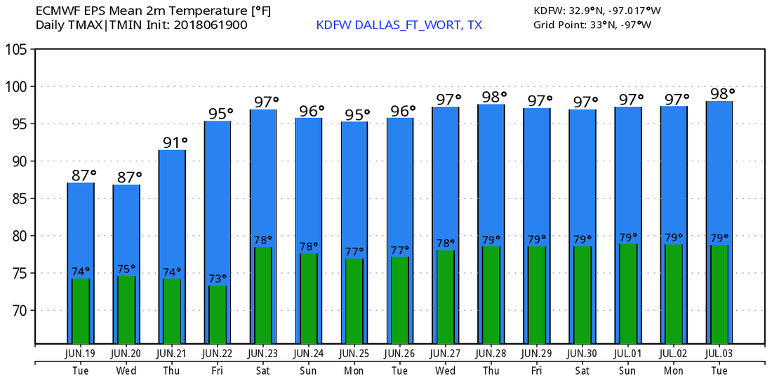 |
Archives
March 2023
Categories |
 RSS Feed
