
|
HOT AND HUMID SUMMER WEATHER: In the moist airmass over North and Central Texas we have a few spotty showers and storms on the radar this afternoon. They are generally moving to the north, and will not last very long at all. Spotty storms will form later this evening, and the best chance of any one spot getting wet is only in the 20 percent range. Expect a continuation of mostly sunny skies with highs very close to 90°. The weather will remain the same tomorrow and Friday; mostly sunny skies with "isolated, mostly afternoon and evening spotty showers and storms". Highs will remain in the low 90s. THE WEEKEND: The hot, humid summer weather continues. We will have a few random, spotty storms around on both days, but just know that there will be no way of knowing exactly where and when they form. Highs will remain in the 90-95 degree range for most places. NEXT WEEK: We will continue with a typical summer time forecast for the Fourth of July week; hot, muggy, mix of sun and clouds with daily chances of "spotty, mostly afternoon and evening showers and storms". Each day will feature highs in the low 90s. See the Texas Weather Discussion Video for more details. 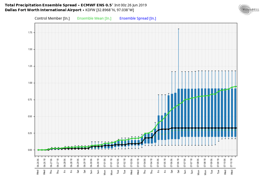 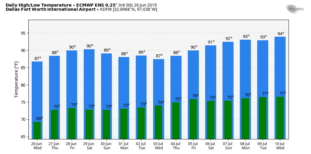 TROPICS: The Atlantic Basin continues to remain very quiet, and tropical cyclones are not expected for the next ten days.
SAL: The Saharan Air Layer will move into a decent chunk of Texas this evening. If you have not heard of this before, it is not common, but not unprecedented. In the long days of summer, dry air from the African deserts move through the Atlantic and the Caribbean, curving into the Gulf of Mexico in high levels. When the SAL creeps into the southern US, because the dust is 5,000 and 20,000 feet in the air, the main effect comes from beautiful sights at sunrise and sunset. |
Archives
March 2023
Categories |
 RSS Feed
