
|
BACK TO NORMAL: Many areas are reporting temperatures in the upper 70s as well as low 80s in the urban areas. Today will be another mostly sunny day with humidity levels on the rise. The high will be in the 92-95° range for most communities. The average high for DFW for July 29 is 97°. A "front" will bring a small chance of isolated showers and storms this afternoon over a good portion of the region. Due to the usual spotty nature of the storms in summer time, it is nearly impossible to predict exact start/stop times, just be aware during the late morning/early afternoon hours. REST OF THE WEEK: Even though the humidity levels will rise again this week, it looks like the weather will stay dry over most of the region through the week with mostly sunny days and fair nights. A few isolated storms could show up over the northeastern corner of the state, but they should be stray and few and far between. Highs tomorrow and the rest of the week will be in the 95-99° range. THE WEEKEND: Not much change. We will forecast seasonal average temperatures along with the typical chance of "isolated, mostly afternoon and evening showers and storms" with highs in the mid 90s. Overnight lows will mostly lie in the mid 70s with a fair sky. NEXT WEEK: Any showers on Monday will continue to remain isolated, but we should trend drier for the rest of the week. Afternoon highs will remain in the mid 90s, just about where they should be for this time of the year. See the Texas Weather Discussion Video for more details. 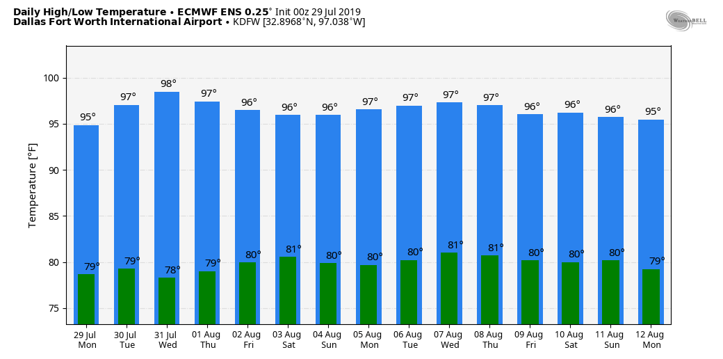 TROPICS: NHC is only giving a 20% chance of any tropical development over the Lesser Antilles, the rest of the Atlantic Basin remains quiet. 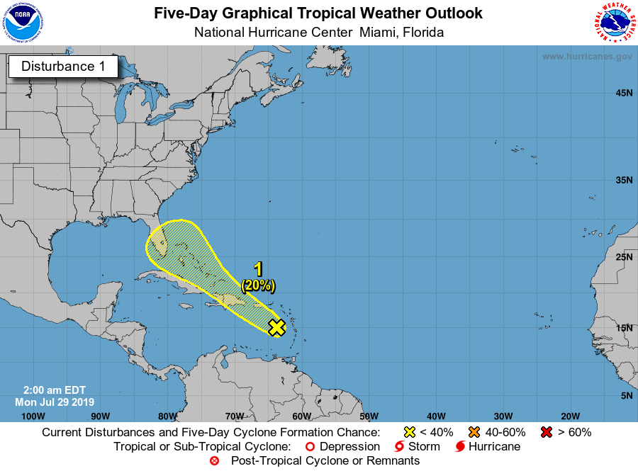 |
Archives
March 2023
Categories |
 RSS Feed
