
|
SUN, HEAT, A STORM: In case you haven't noticed already, North texas will be in a routine summer weather pattern for the foreseeable future. The mid-latitude westerlies are well to the north, but that isn't stopping storms from developing in Central Texas today, and we will once again deal with random, spotty showers and storms during the afternoon and evening, mainly over our southern counties. The chance of one spot getting wet is only in the ten percent category, and the high this afternoon will be in the low 90s. TOMORROW THROUGH NEXT WEEK: We will roll with a persistent forecast over the next week; mix of sun and clouds, hot, humid days with daily chances of "spotty, mostly afternoon to evening showers and thunderstorms". Some outflow winds are possible with these storms, and we will have no way of knowing exact start and stop times and where they form. Of course there will be some differences of storm placement each day due to small scale features, but will have no way of knowing in advance. Odds of any one spot getting wet each day will still be in the 10-20 percent bracket, and afternoon highs will be in the low 90s, typical weather for late June here in North Texas. See the Texas Weather Discussion Video for more details. 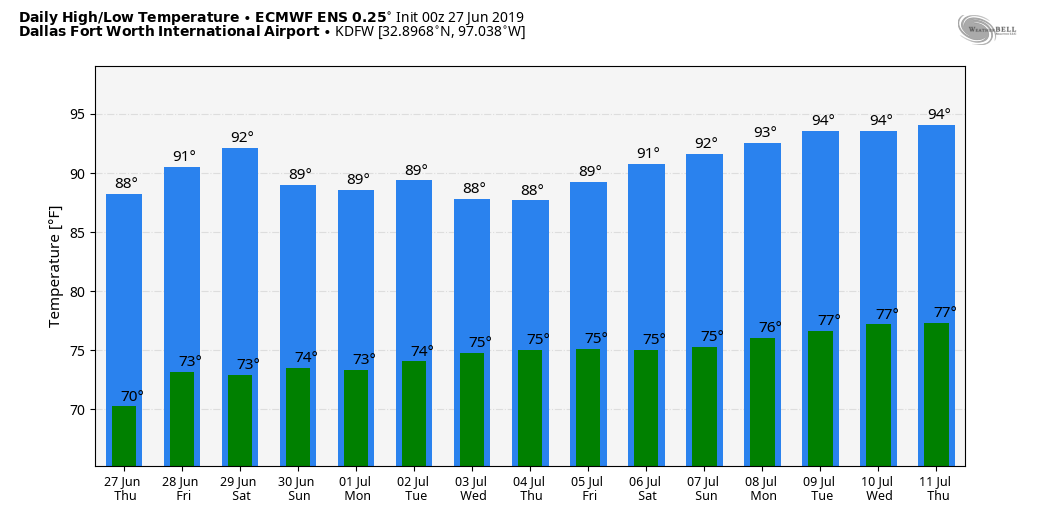 TROPICS: The Atlantic Basin continues to remain very quiet, and no new tropical cyclones is expected through next week.
|
Archives
March 2023
Categories |
 RSS Feed
