
|
RADAR CHECK - As advertised, widespread rainfall is continuing to move northeast. This rain stretches all the way down to Southwest Texas. Today will feature something that we will always take; a good, long day of soaking rains across the region. A few thunderclaps is possible in the mix, and the threat for severe weather this afternoon and evening is extremely low, but not zero. 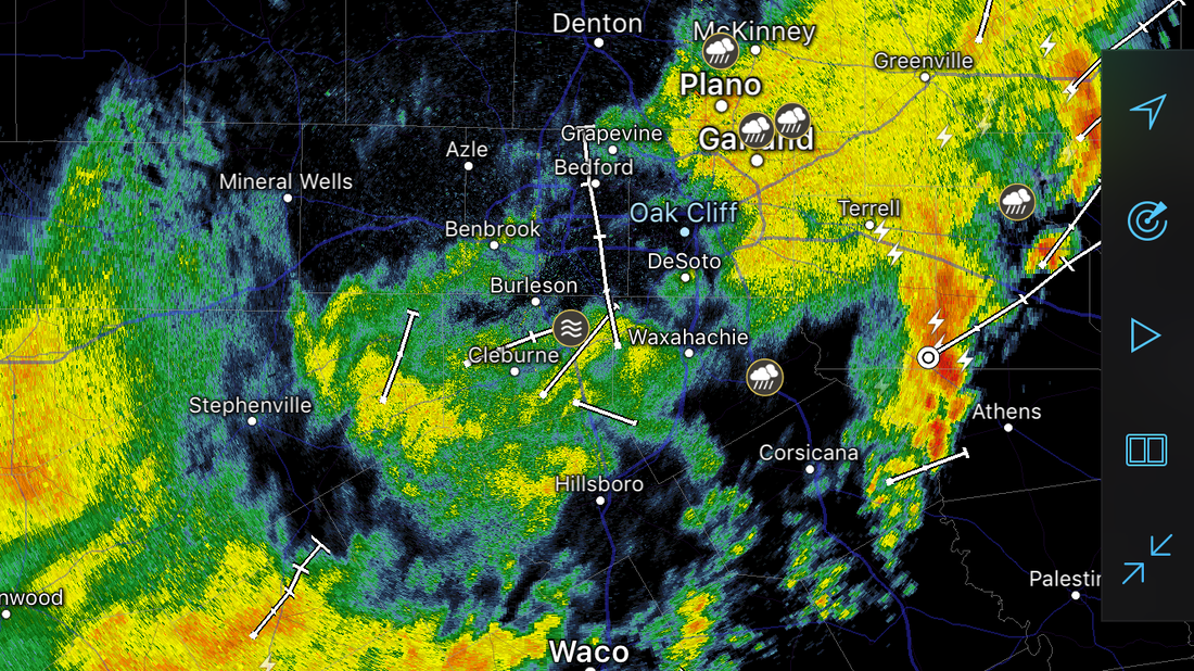 The main threat we will have to deal with is heavy rainfall. Although the showers and storms will be moving at a good speed, we could still see flooding in the North Central Texas region today as more rain will move over the areas that have already received copious amounts of rainfall yesterday. We will not warm much at all today, as temperatures should stay in the 60° range. As storms exit the region tonight, we could still see some lingering showers and storms during the morning hours tomorrow, but most of the showers will be gone by the afternoon, and we will mention slowly decreasing clouds in the afternoon and evening. Highs will be in the mid 70s. FRIDAY AND THE WEEKEND: We change seasons once again over the next few days. Each day will feature a mostly sunny skies with highs in the low to mid 80s throughout the weekend. Winds may increase progressively, but it should be a very nice weekend. NEXT WEEK: An active week of potentially stormy weather is possible across the south-central US. More details will become available as soon as they get ironed out, but expect seasonably warm temperatures with a mix of sun and clouds next week. 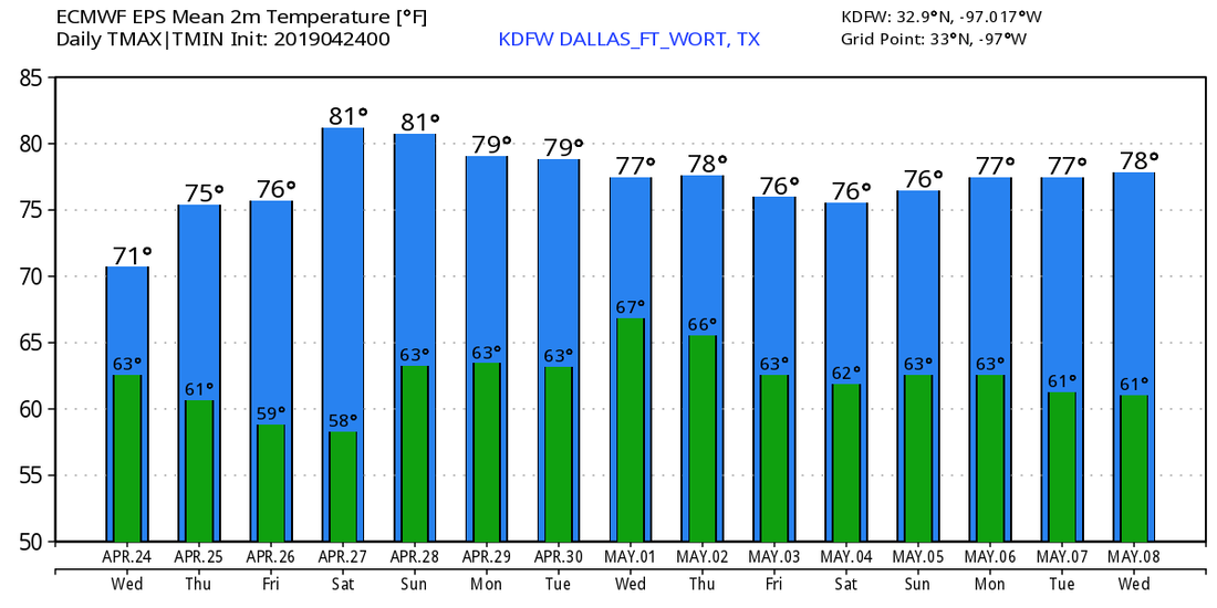 |
Archives
March 2023
Categories |
 RSS Feed
