
|
*no Texas Weather Discussion Video this morning* RADAR CHECK - Isolated showers and thunderstorms are about in North Texas this morning with temperatures mostly resting in the middle 70s. The good news is we won't warm much this afternoon with temperatures only reaching the mid 80s.  We will also increase the chance of widespread scattered showers and thunderstorms as a surface front interacts with deep moisture. Expect things to get wet starting late morning into the afternoon hours. Rainfall amounts of around 5-6 inches is expected through the weekend, and a Flash Flood Watch is in effect for parts of the North Texas area from this morning through Saturday Evening, but will likely be extended into Sunday and even early portions of next week. The best coverage of widespread showers and thunderstorms will begin this evening, lasting through Friday night and through Saturday morning. 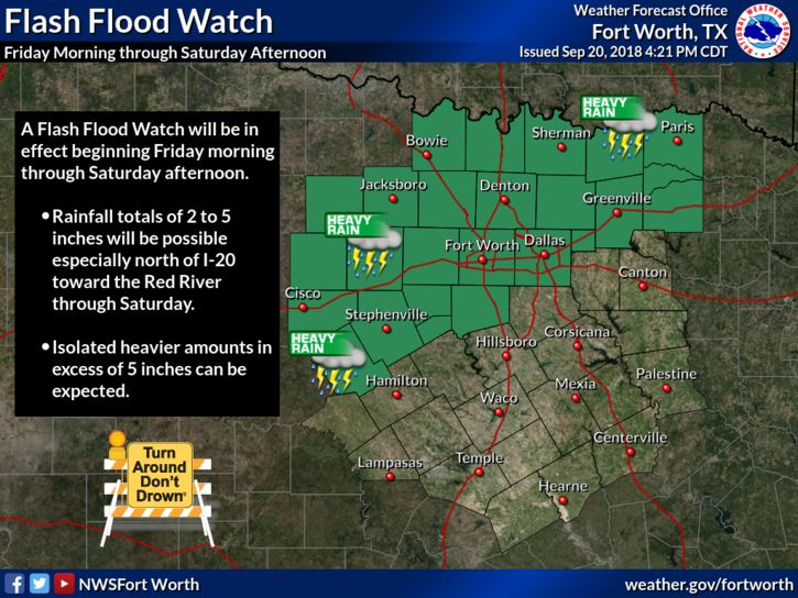 Saturday will just be a wet, muggy day with heavy rain and thunderstorms likely. Temperatures will hold in the upper 70s due to rain cooled air with mostly cloudy skies. Then, we will continue to mention the chance of scattered thunderstorms on Sunday as our surface front starts to move east. The highest chance of one spot getting wet is in the 50/50 percent range. Like Saturday, highs will stick into the upper 70s. NEXT WEEK - It sure looks like most of next week will be mostly cloudy with occasional scattered showers at times as the air remains moist and unstable, and the much anticipated front gets closer. The highest coverage of rain looks to come Tuesday and Thursday, then just a risk of a few passing showers on Friday as the much anticipated front arrives. For next weekend, it is becoming clear that we will see a mix of sun and clouds with highs in the upper 70s and morning lows in the upper 50s. A couple of naturally cooler spots have a chance of seeing mid 50s... 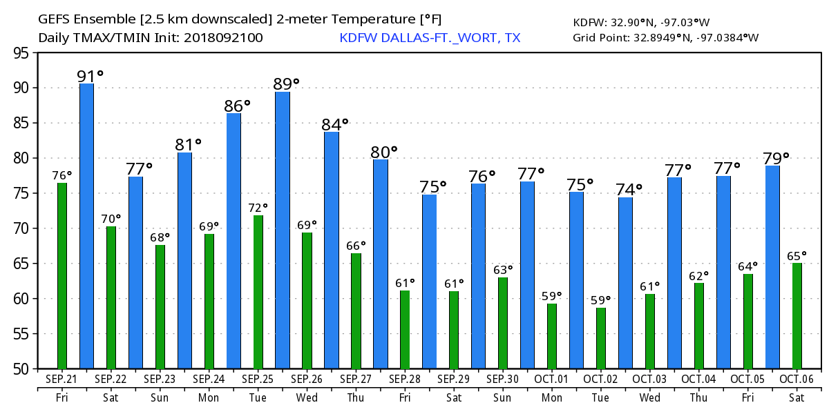 TROPICS - A disturbance in the Central Atlantic has a 70 percent chance of developing within the next five days. There is also another wave off of the coast of Africa that could show development this weekend. The other waves show very little signs of development. 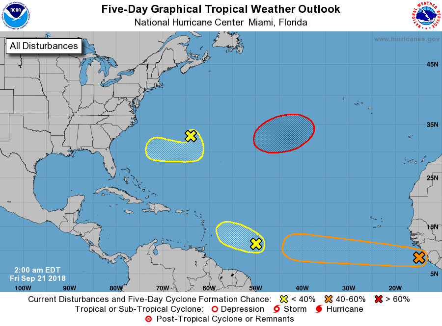 |
Archives
March 2023
Categories |
 RSS Feed
