
|
CHILLY AND DRY: As this day begins we have temperatures mostly in the upper 30s across North Texas in a cold airmass. In wake of a warm front, today will feature a mix of sun and clouds with highs in the upper 50s this afternoon. Another warm front will move to the north tomorrow, which will pull some moisture along with it. As a result, we will introduce mostly cloudy skies tomorrow with highs in the mid 50s. I wouldn't be totally surprised if we squeeze out a few showers from the moisture. FRIDAY AND THE WEEKEND - The warm front moving through the region by Friday will cause another chance of scattered showers and thunderstorms from the afternoon during the overnight hours on Saturday. There will be at least some instability in place, which is why the SPC has defined a "marginal" risk of severe storms for areas along and east of interstate 35. 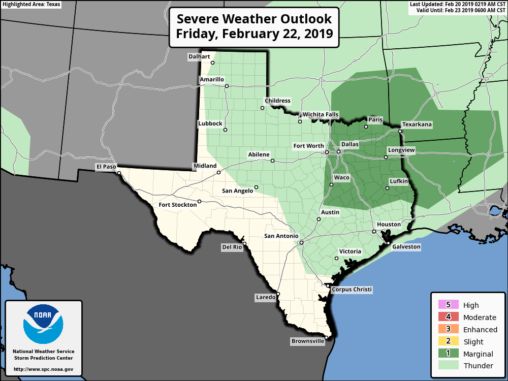 Only a few strong to severe storms are possible out of the mix, which may pose a risk for isolated hail and damaging wind gusts, nothing to bad. That storm system, along with the risk of severe weather, will shift to the east Saturday afternoon. We will remain mostly dry on Sunday with sunshine in full force with afternoon highs in the mid 60s. NEXT WEEK - Much of next week will be dry, but some showers could return on Saturday. Thankfully, it looks like that should be the only wet day of the week. See the Texas Weather Discussion Video for more details. 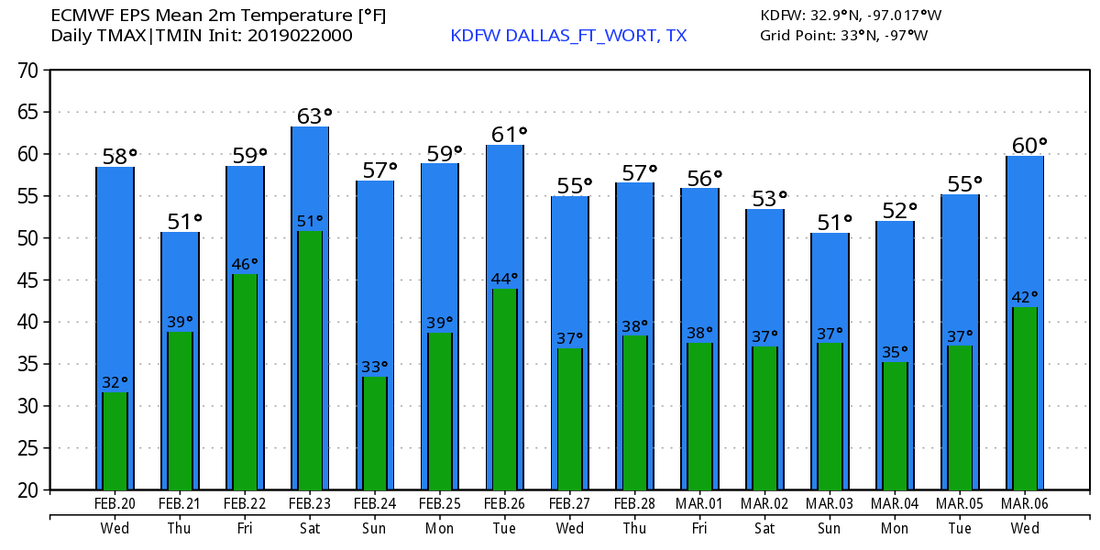 |
Archives
March 2023
Categories |
 RSS Feed
