
|
DRY MORNING - For the first time in a few days, the radar is actually clear of any heavy downpours this morning, pretty fitting for the first day of school for some of us. There were some showers just to the northeast of College Station that will eventually fade away during daybreak. Temperatures are mostly in the mid to upper 70s this morning, but we will warm to the mid 90s later today with a mix of sun and clouds. Not much change in the weather tomorrow either. The afternoon will be hot and humid with highs in the middle to upper 90s. An isolated shower or two during the afternoon is never ruled out with lingering moisture in the state. FRIDAY AND THE WEEKEND - Our weather really doesn't change much for the weekend. Expect hot and humid days with more sun than clouds. It will continue to feel rather humid with highs in the mid 90s all weekend, certainly better than 100° heat. NEXT WEEK - An upper trough in the northeastern U.S. will push a surface front to the south which will lead to isolated showers and storms during the early part of next week. Rain chances will stay low with the best chance of any one spot getting wet in the 20 to 30 percent range. Look for highs in the low 90s for most of next week. See the Texas Weather Discussion Video for more details. 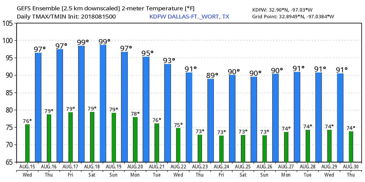 TROPIX - Subtropical Depression Five formed earlier this morning in the Central Atlantic. It will become Subtropical Storm Ernesto later today. The good news is that it will kick off to the northeast, away from the U.S. The rest of the Atlantic Basin remains very quiet. 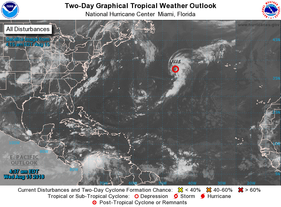 |
Archives
April 2024
Categories |
 RSS Feed