
|
ALREADY WARM: We already have low to mid 80 readings across the metroplex this morning with very humid conditions... Temperatures will be in upper 90s again with mostly sunny skies today, and a Heat Advisory remains in effect for ALL of the North-Central Texas region until 7PM today. Then, a complex of strong thunderstorms from Oklahoma will move southward towards the metroplex, affecting the area at around 10-12PM. Gusty winds are possible, as well as some hail at times, but do not expect anything widespread. REST OF THE WEEK THROUGH NEXT WEEK: Not much change. Each day will feature mostly sunny skies with a few clouds in the mix, hot and humid conditions with hidden daily chances of "spotty, mostly afternoon and evening showers and storms". Highs will be in the mid to upper 90s each day. We will maintain a dry forecast for North Texas for the weekend for the time being. ALL EYES ON THE GULF: A disturbance that is now in water at this point is expected to become better organized over the coming days, ultimately becoming a tropical storm within the next 48 hours. It's name will be Barry if it becomes a tropical storm. 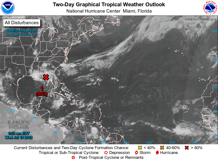 It will drift to the southwest slowly. bringing unsettled weather to the Central Gulf Coast inland into parts of the Deep South over the coming days. Here are the main takeaways. -Intensity guidance this morning is going a little more on the aggressive side on the storm, suggesting it might be a high-end tropical storm to minimal hurricane by Saturday. For now, we are still expecting this to remain below hurricane strength, but this will definitely change within the coming days. 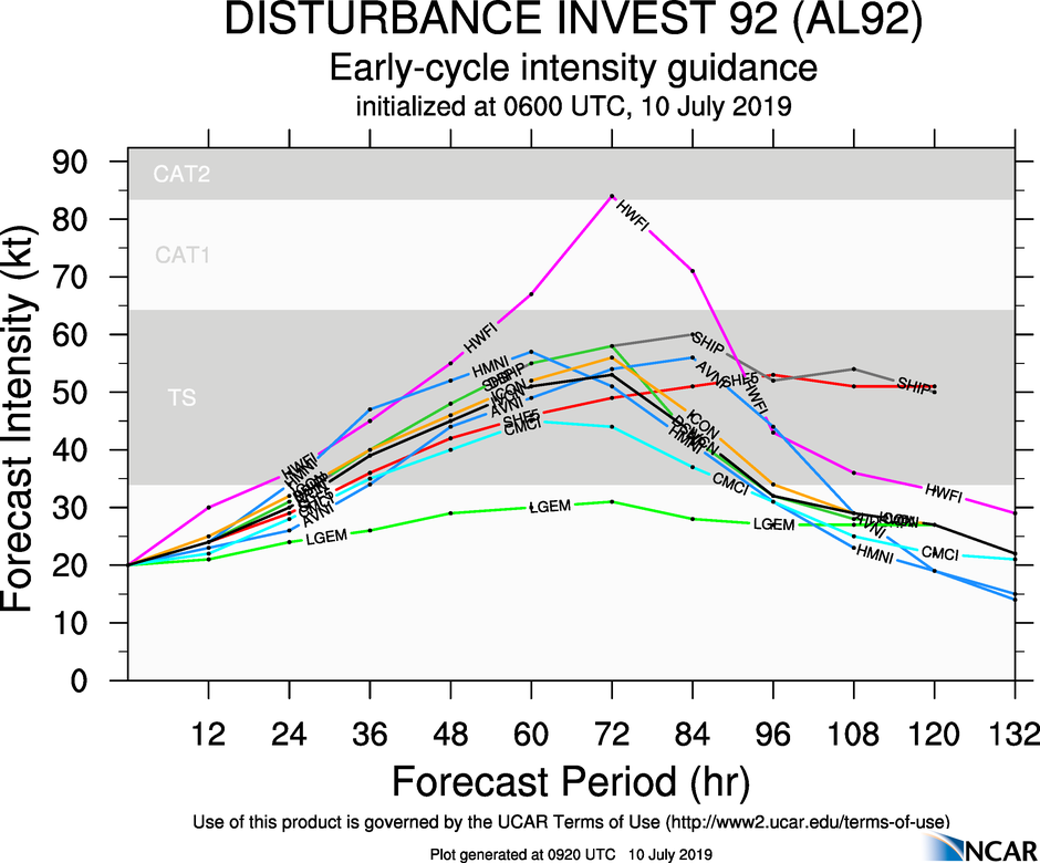 -The main impacts from this thing will come from heavy rain which may lead to flooding, and rough surf/rip currents. Gusty winds will also be likely, and a few brief waterspouts/tornadoes are possible Thursday and Friday along the coast. The SPC has a "marginal risk" for severe storms defined for parts of the Florida Panhandle, and the coasts of Alabama, Mississippi, and Louisiana. -The system should drift inland somewhere over Louisiana Saturday evening. Do not focus on the circulation center too much. Heavy rain will be possible a couple hundred miles to the east and north of the center of circulation. 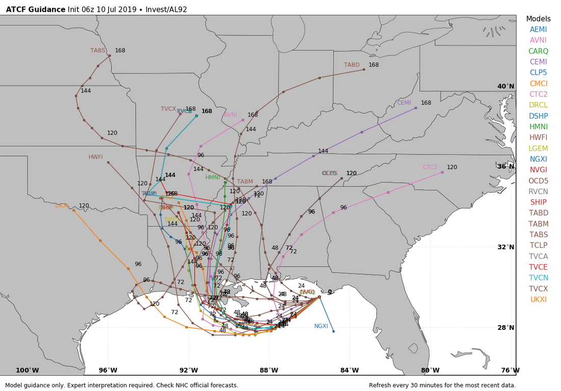 -Once we establish a center of circulation in the Gulf, there will be much better confidence in impact and exact tracking forecasts. This should happen later this evening.
See the Texas Weather Discussion Video for more details. |
Archives
March 2023
Categories |
 RSS Feed
