
|
Dry But Foggy Start - A dry start is something that we haven't seen in a while. Temperatures are in the mid 40s across North Texas, but dense fog continue to remain in place this morning. In fact, a dense fog advisory remains in effect until 10AM this morning, where all fog will clear out. Visibility will remain low with 1/4 mile or less. After the fog clears out, we should clear to abundant sunshine during the afternoon hours with highs in the mid 60s. Rain returns to the state tomorrow, mainly during the afternoon and evening hours. A few strong thunderstorms could turn marginally severe, where the SPC has placed much of North Texas under a 'marginal' risk for severe storms. Hail will be the primary concern with the strongest cells. Most of the rain will begin during the late afternoon and evening hours, though we could see a few scattered storms on radar during the late morning hours. Highs will be in the low 60s. Wednesday Through Friday - Wednesday maybe a mostly cloudy day with occasional showers throughout the morning hours. We could see some thunderstorms take place during the afternoon hours. We do note that the SPC has a risk of severe weather defined just to the east of here... with a marginal risk clipping Fort Worth and surrounding areas. 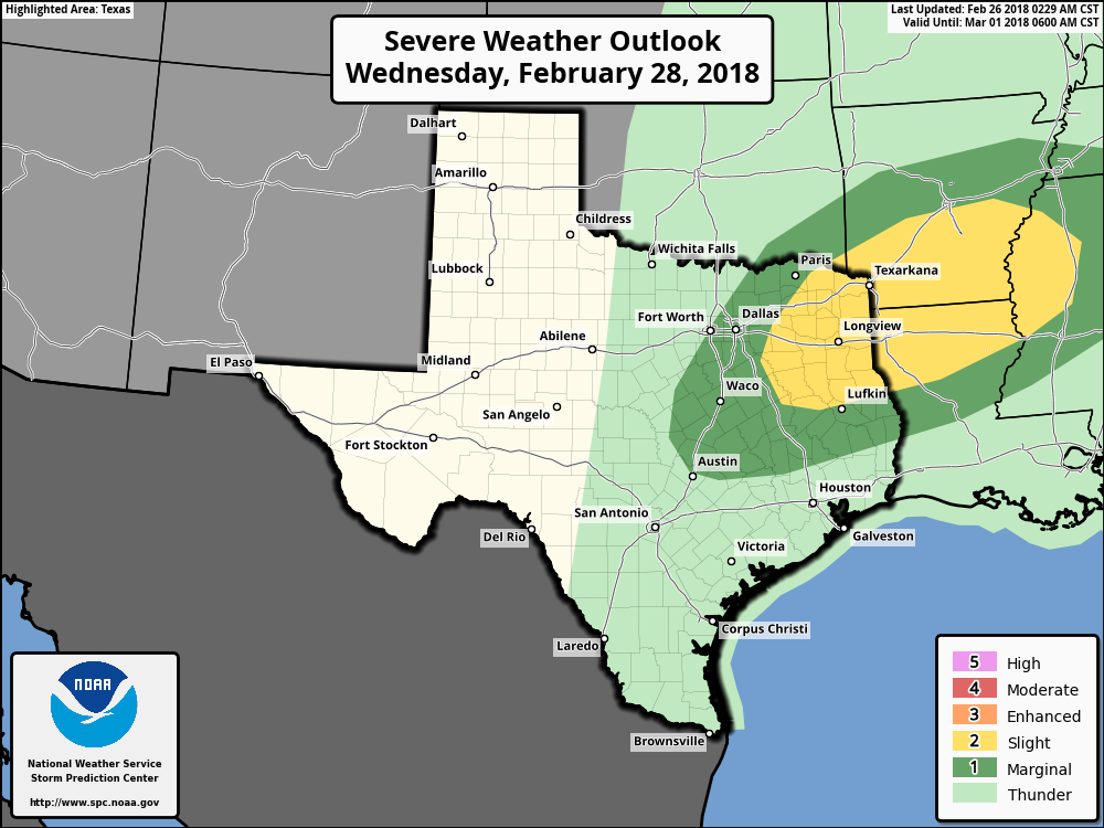 We should be in the mid 70s on Wednesday, then cold air advection from the cold front keeps us in the upper 50s on Thursday. Rain amounts this week should be in the 1/2" - 1" range. We still remain dry on Friday with highs in the mid 60s and sunshine out in full force. The Weekend - After this week, we will enjoy a dry weekend for a change with afternoon highs in the low 70s with morning lows in the mid to upper 40s. Sunshine should be out in full force this weekend. Next Week - We will mention the chance for a few scattered showers returning on Monday. Warm, dry air sticks with us for the rest of the week. See the Texas Weather Discussion Video for more details. 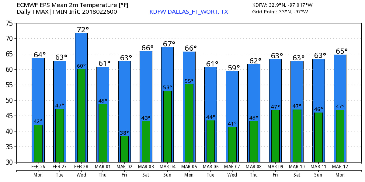 |
Archives
March 2023
Categories |
 RSS Feed
