
|
ANOTHER DRY, PLEASANT DAY AHEAD - Temperatures are in the mid 40 to mid 50 degree range across the region, and today will be a few degrees cooler than yesterday with a high around 70 degrees with a southeast wind of around 10-15mph. Clouds will increase throughout the day with an approaching cold front and rain out in West Texas. Then tonight will become overcast as clouds roll through with overnight lows in the low 50s. RAIN/THUNDERSTORMS SATURDAY - Saturday looks like a very wet day as a low pressure area will move into the west Texas, passing to the southeast during the day. Rain should begin during the morning hours at around 7 to 8am in the North Texas area. We could see a break in the rain during the afternoon, but then a few thunderstorms are possible during the evening as a second band of rain is likely. It must be noted that the SPC has outlined a "marginal" risk for severe storms for all of North Texas and areas to the north of the Red River. 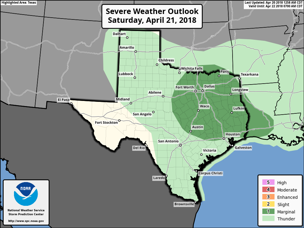 Storms should remain very isolated in coverage, and this will not be a widespread severe weather event. But with the few storms that do end up turning severe, we could see some produce some large hail at times. Also, I wouldn't completely rule out the possibility of a brief tornado with the strongest cell. Thunderstorms should develop pass 6P, tapering off to the east during the overnight hours. The high will be at around 67. Once the activity pushes off to the east, that will give off to a dry day on Sunday with afternoon highs in the upper 60s. It will still be cloudy though. NEXT WEEK - The early part of next week looks dry. A cold front will move through on Wednesday, and that could set off the possibility of scattered showers and storms. We then warm substantially to the low 80s during the latter half of the week. See the Texas Weather Discussion Video for more details. 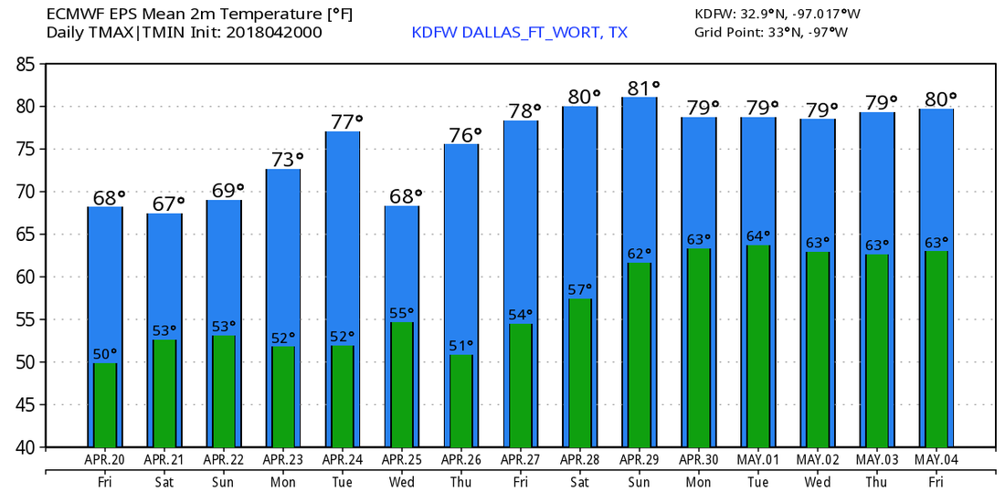 |
Archives
March 2023
Categories |
 RSS Feed
