
|
Below Average - Today will be a much fall-like November day with way more clouds than sun. The high will be in the upper 50s/low 60s in most spots. The average high for November 7 in DFW is 69. A storm or two is still not out of the question, but most communities will remain dry today. Large Contrast - Large contrast in temperatures across the nation this morning... Harve, Montana is down to -8F at 3AM MST. Houston, Texas vicinity reports 75 degrees at the same time. 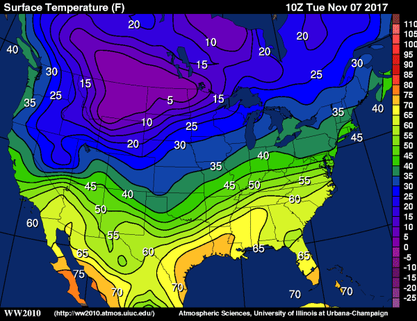 Cold, Wet Wednesday - Showers and storms become likely tomorrow as wave of low pressure enters the area. Looks like we will have a chance of rain all throughout the day, but the brink of it should come during the afternoon and evening hours. Be sure to dress and prepare for it to rain all day on Wednesday, as scattered, random showers and storms will be possible before the main event comes. Rain amounts should generally stay in the one inch range, with higher amounts to the south of North Texas. Otherwise, expect a cold, muggy day with highs only reaching the mid 40s and some lows reaching to the upper 30s. Thursday and Friday - Rain ends early Thursday morning; the sky become partly to mostly sunny with a high just below or at 60 degrees. Friday is another comfortable day with increasing sun, beginning the day in the low 50s, warming to the mid 60s for highs. The Weekend - The day on Saturday should be nice and dry with highs in the low 70s. Clouds will overspread the region on Sunday, but for now, highs still remain in the upper 60s. Next Week - Cool weather continues for North Texas for the next week. No signs of any severe weather issues across the south for the next ten days... See the Texas Weather Discussion Video for more details. 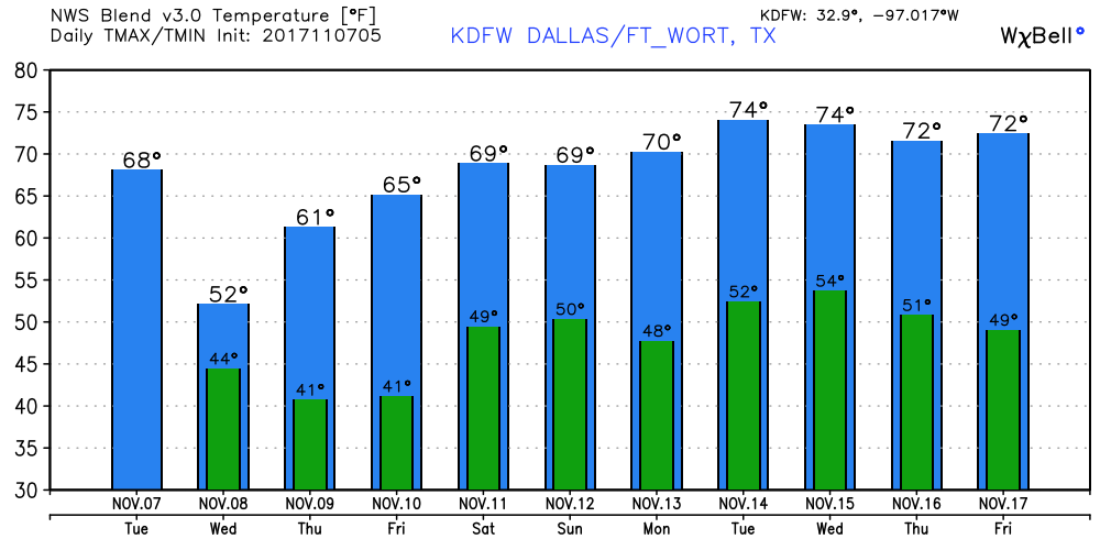 Tropics - Tropical Storm Rina is still in the Central Atlantic and poses no threat to land... It should stay in the open Atlantic. The rest of the basin is quiet.
|
Archives
March 2023
Categories |
 RSS Feed
