
|
CHILLY START - Temperatures are in the middle 50s to start the day off... Probably the coolest we have been since April. We project a high closer to 70 degrees today with mostly sunny skies. We have been getting a real feel of fall for the past few days and it is only expected to continue. FRIDAY AND THE WEEKEND - A little bit of moisture starts to move to the east by Friday, and we will mention a few scattered showers during the afternoon and evening. The best chance of a spot getting wet is in the 20/30 percent range, and highs will be closer to 70 degrees again with partly to mostly sunny skies. The remnant low of Tropical Storm Sergio in the Eastern Pacific will move inland to the northeast towards North Texas on Saturday. The best chance of rain this weekend will lie during the afternoon/overnight hours on Saturday as the low moves to the northeast. A cold front comes through late Sunday morning, which will promote cooler temperatures for the rest of the day. We will mention partly to mostly cloudy skies with highs hovering in the low 70s/upper 60s. NEXT WEEK AND BEYOND - Moisture begins to plume over Texas, which signals even more chances of scattered showers and thunderstorms. The chance of one spot getting wet is around 50/50 for Monday at that point. Highs will be in the mid 50s and morning lows in the mid 40s, about 25-30 degrees below our average high of 80. 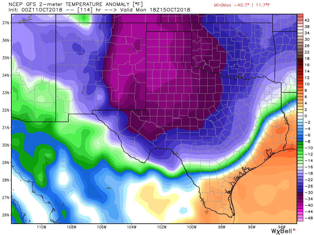 We will continue to have cool, crisp air for the rest of the week with afternoon highs in the 60-70 degree range with morning lows in the low to mid 50s. And the CPC (Climate Prediction Center) suggests that we will have below average temperatures for the next 6-10 days. With strong cold front that will come through Sunday morning, we will experience multiple chilly mornings and cool, crisp afternoons for a while, a true feel of what fall is like. See the Texas Weather Discussion Video for more details. 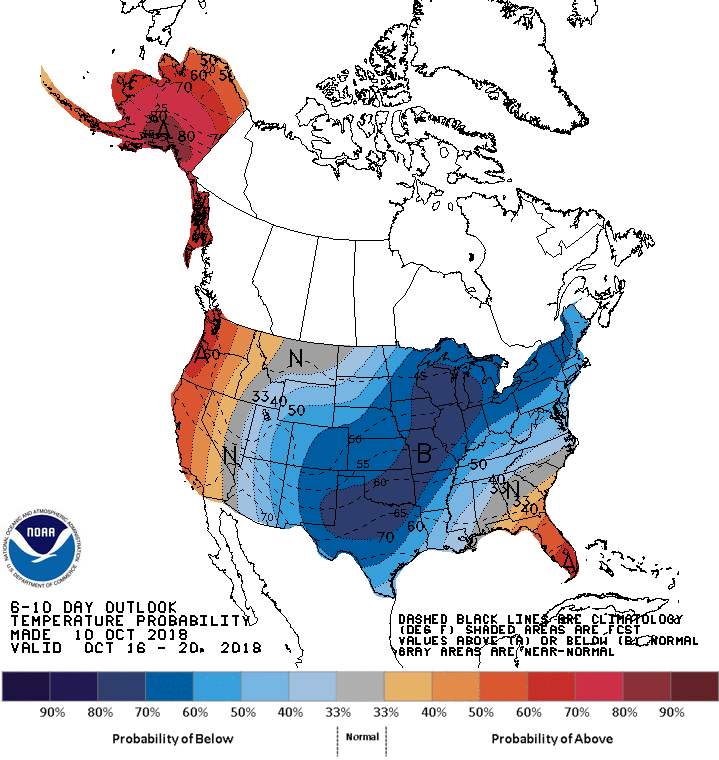 TROPICS - In the Atlantic Basin, we have a total of three named storms.
Tropical Storm Nadine will dissipate this weekend with no threat to land. Hurricane Leslie will weaken and become post-tropical by this weekend with no threat to land. Tropical Storm Michael is moving through the Carolinas at this time. It will continue to move to the northeast and become post-tropical once it hits the water again. From there, Michael will continue its journey to the northeast with no threat to land. And, there is another wave in the Caribbean Sea that has a 50/50 chance of becoming a tropical depression in the next five to seven days. This will impact Mexico with no threat to the U.S. |
Archives
March 2023
Categories |
 RSS Feed
