
|
Air You Can Wear - A cool, but comfortable morning is in store for those traveling to work and school; temperatures are mostly around the upper 40s and low 50s. We should only warm to the mid 70s in most spots today with abundant sunshine. A cold front will come through later today which will set the stage for a much cooler day along with rain chances tomorrow. Highs mostly in the mid 50s on Tuesday, with the chance for scattered showers and storms during the late afternoon and evening hours. Trick-Or-Treat? - We do think that most of the rain will come when it is time to go hunting for candy. The latest run of the North American Model (NAM) currently shows the likely time of showers and storms to be 3PM - 8PM. If you still plan on going trick-or-treating, make sure you plan ahead and bring umbrellas and jackets just in case something decides to pop out after sunset. Otherwise, the high for Halloween will be in the mid 50s. Wednesday Through Friday - We start November warm and dry with highs mostly in the 80 degree range with abundant sunshine. No signs of any precipitation at this point. The Weekend - Not much change. Warm, but comfortable weather in store for the weekend, with highs in the 80-84 degree range with clouds out at times. Next Week - After Monday, temperatures cool down to the low 70s to upper 60s, adding a chance of showers early next week, but no signs of any widespread rain anytime soon. 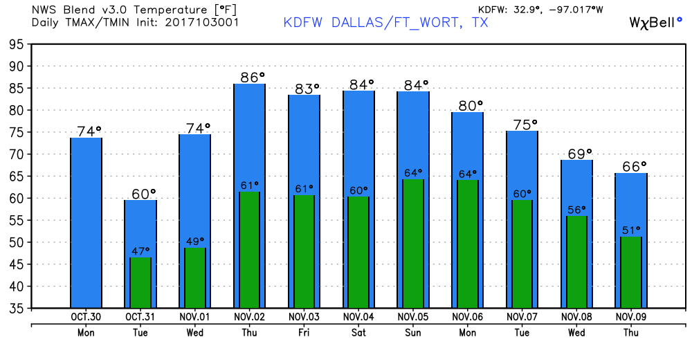 Tropics - The disturbance that was known as the remnants of Phillipe is now a Nor'easter in the northeast, bringing heavy rain and floods to that part of the region.
There is another wave that currently has a medium chance of developing during the next five days. If anything decides to surprise us, it should just meander over the Central Atlantic, posing no threat to the U.S. The rest of the Atlantic basin, is quiet. See the Texas Weather Discussion Video for more details. |
Archives
March 2023
Categories |
 RSS Feed
