
|
FAIR MORNING - Temperatures are currently in the mid 50s with a mostly cloudy sky. We won't warm much today as rain-cooled air keeps us below 60°. Tropical Depression Willa in Central Mexico will dissipate into an open wave later today, but its wave energy will spin a low in the Gulf and move to the northwest which will cause widespread rain chances for most of the state this afternoon. The main window of the highest probability of rain will be from 11:00AM-12:00AM. Some rain may persist into early Thursday morning in some spots. Rain amounts will be in the 1"-1 1/2" range for most communities in North and Central Texas today. Since we are in a cool, stable airmass, lightning and thunder will not be of concern today, just periods of heavy rain at times. The rainmass will move to the east early Thursday morning, and afternoon highs will be in the mid 60s on Thursday partly to mostly cloudy skies. FRIDAY AND THE WEEKEND - We revert back to a nice, stable fall weather pattern with mostly sunny skies and highs in the low to mid 70s with morning lows in the upper 40s to low 50s. No rain is expected through the weekend. NEXT WEEK - Next week becomes questionable in terms of rain chances. Recent guidance shows at least some chance of showers and storms by Halloween with a cold front moving to the east. But then Friday might be a wet day with lingering moisture. Too early to tell at this point, so we will leave a mostly dry forecast next week with afternoon highs mostly in the low to mid 70s. See the Texas Weather Discussion Video for more details. 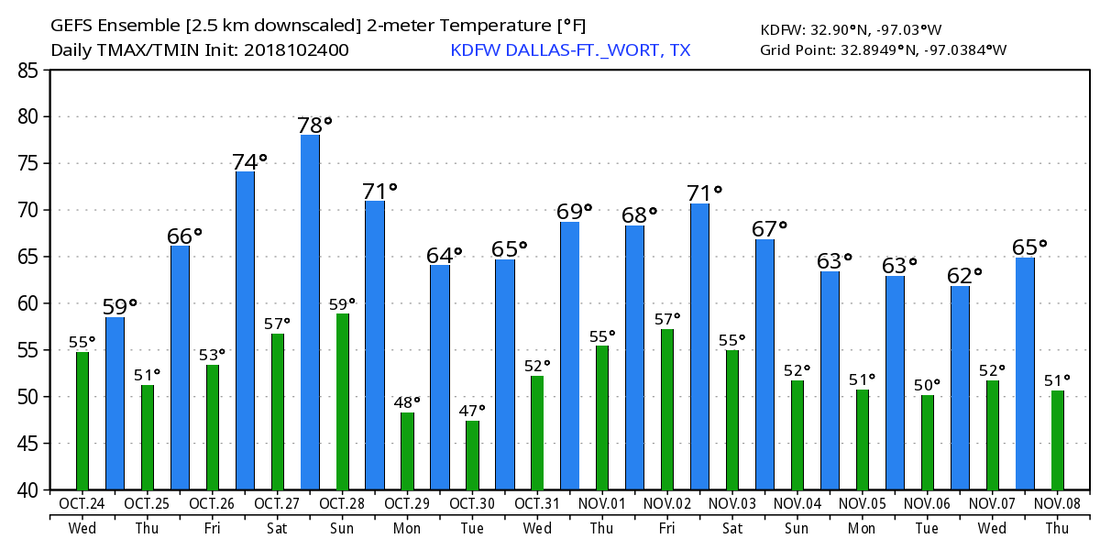 TROPICS - There is a broad low in the central Atlantic that the NHC gives a 50/50 chance of developing into a tropical depression or storm this weekend... It will gain a little bit of latitude before turning to the west. It is way too early to pinpoint whether or not this will have an impact on the US East Coast. The rest of the Atlantic Basin is quiet. 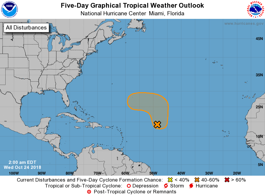 |
Archives
March 2023
Categories |
 RSS Feed
