
|
Another Relatively Mild Start - Although it does say "comfortable" in the title, we still start the day with highs mostly in the low 60s in DFW. As I write this, the surface front is literally on top of North Texas. I will let you pick out where it is. 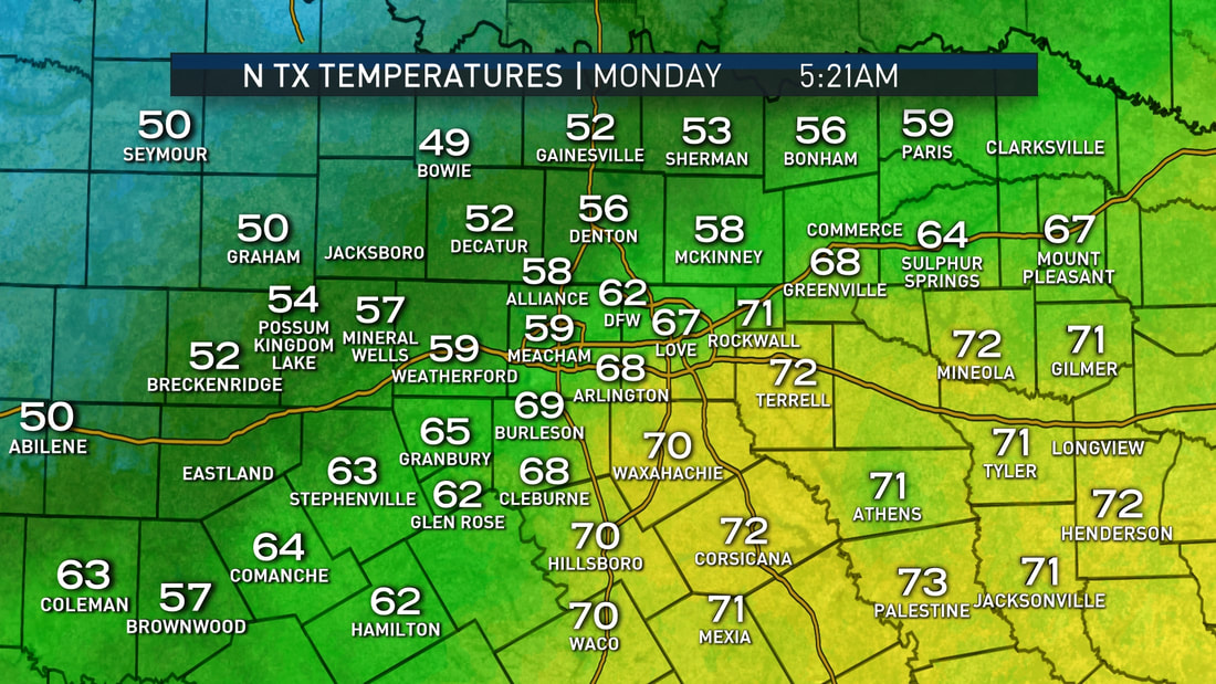 As a result of the cold front, highs will only reach the mid to upper 70s in most spots with clouds out at times. Tuesday - We start to trend cooler with lows potentially in the 40s and highs in the mid 60s. It will still be cloudy at times, but nothing out there to suggest a widespread overcast. Wednesday Through Friday - A disturbance makes its way through the area on Wednesday, which means rain becomes likely during the day. Scattered to numerous showers and storms appear likely during the day on Wednesday, which will bring temperatures down to the upper 40s/low 50s for highs. Lows might even reach the 30s in some spots. Rain amounts should stay within 1 to 1 1/2 inches in North Texas. After Wednesday, we clear out in a dry airmass, which means that the rest of the work week looks quiet and dry with highs in the low to mid 60s, which will be perfect for high school football games on Friday. The Weekend - Not much change. A few scattered showers will be possible on Sunday ahead of another cold front, but a widespread rain is not expected at this time. We continue forecast a dry weekend with highs in the low 70s. Next Week - Another fall like start to the week is expected with highs only in the 60s from now on. Seems like we get rid of 80 degree weather for a long time. See the Texas Weather Discussion Video for more details. 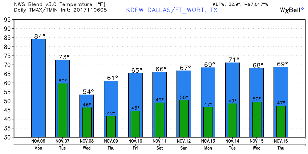 Tropics - A wave (that reminds us that hurricane season runs all the way through November 31) named Tropical Depression Nineteen is in the Central Atlantic, and is expected to become Tropical Storm Rina within the next 12 hours. If anything forms, it should just move out to the Northern Atlantic, posing no threat to land. The rest of the Atlantic Basin remains quiet. 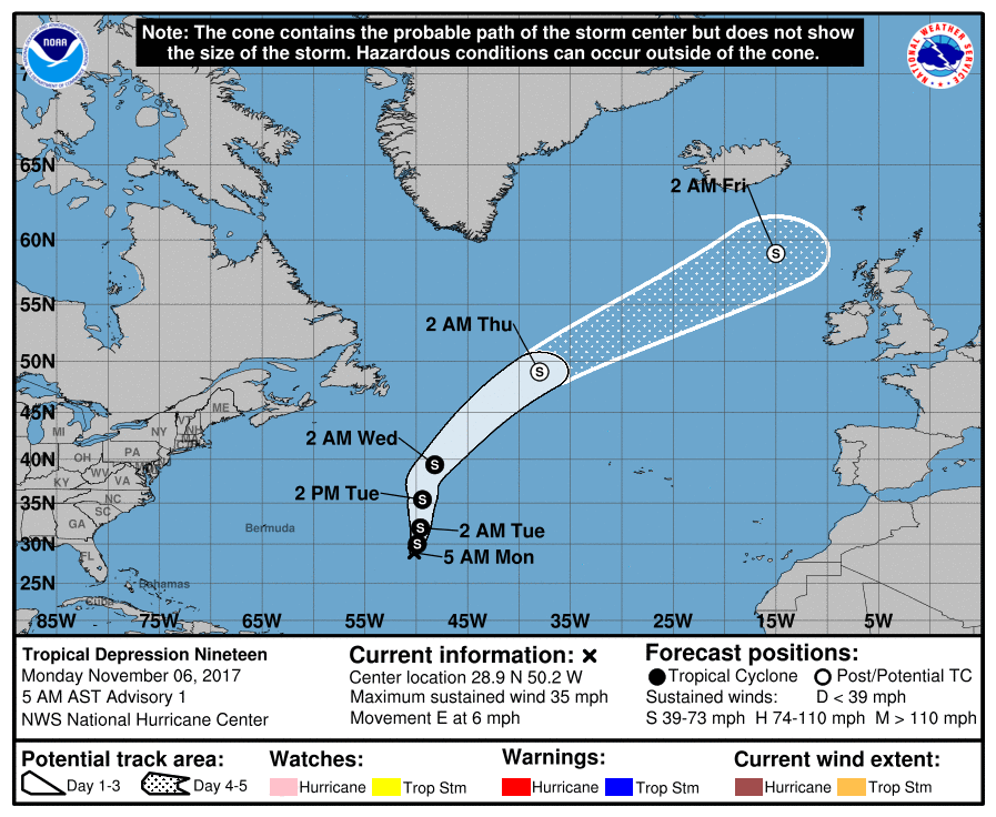 |
Archives
March 2023
Categories |
 RSS Feed
