
|
RADAR CHECK - With the strong cold front coming through, scattered showers and thunderstorms are occuring over parts of North Texas this morning. 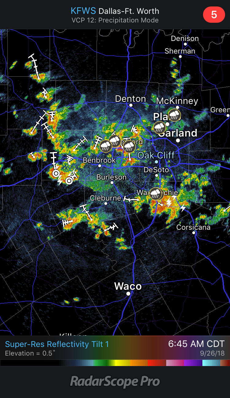 Some of these storms are producing heavy rain, frequent lightning, and gusty winds. These will become more widespread in coverage as we progress through the morning, eventually dissipating as we get into the late afternoon hours.
As a result of the strong cold front, temperatures will go the wrong way today. We are currently in the middle 70s right now. We will fall to the middle to upper 60s by the afternoon; a 30° difference from yesterday's high. The cold front moves to the south tomorrow, and we will maintain a dry, cool forecast with highs in the mid 70s and morning lows in the mid 60s with a mix of sun and clouds. FRIDAY AND THE WEEKEND - Global models have trended much drier for the three days, and we will mention the chance of only isolated showers on Sunday with a mix of sun and clouds on all three days. Highs will be in the low 80s. NEXT WEEK - Next week for the most part looks fairly dry, though we will still mention a small chance of an isolated shower or two during the early parts of next week. Highs will mostly be in the low 80s. The GFS continues to show the idea of a long wave upper trough over the eastern third of the country, which would have the potential of bringing cooler temperatures down south. Will continue to monitor trends. See the Texas Weather Discussion Video for more details. TROPICS - Kirk regenerated into a tropical storm late last night. It is continuing to move east towards the Lesser Antillies. It will eventually end up in the Caribbean as a tropical depression, becoming post-tropical by Sunday. All of the other waves in the Atlantic only have a low chance of regeneration. There is nothing expected to impact the Gulf of Mexico at this present time. |
Archives
March 2023
Categories |
 RSS Feed
