
|
RADAR UPDATE - There is a cluster of isolated showers along and south of I-30 this morning, slowly moving to the north. A few other showers and rumbles of thunder are present near Meridian, mainly to the west of I-35. All of these showers will continue through most of the day, but should not be a widespread rain event. TOMORROW THROUGH THE WEEKEND - Our weather will remain the same for the rest of the workweek through the weekend; mostly cloudy with a few instances of clouds along with the chance of isolated showers during the morning, becoming more scattered by the afternoon as the tropical atmosphere continues. Afternoon highs will be in the mid 80s through Friday, warming slightly to the upper 80s by the end of the weekend. NEXT WEEK - Confidence is starting to increase that a good part of next week will continue to remain dry with a mix of sun and clouds on most days. The upper ridge over the Central U.S. holds, which means afternoon highs will still be in the low 90s. Remember, we usually don't see a good surge of cool air until we get into late September/early October. ALL EYES ON FLORENCE - Florence is still a dangerous Category Four Hurricane in the Atlantic with sustained winds of 130 mph. She is expected to intensify today as she moves into the warmest waters she has been in. While weakening is possible right before landfall, Florence is expected to still be a major hurricane while along the North Carolina Coast. The forecast track continues to shift to the south. Please note these changes in the forecast. 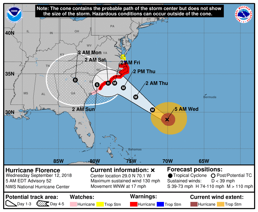 Here are the latest Key Messages... 1. A life-threatening storm surge is now highly likely along portions of the coastlines of South Carolina and North Carolina, and a Storm Surge Warning is in effect for a portion of this area. All interests from South Carolina into the mid-Atlantic region should complete preparations and follow any advice given by local officials. 2. Life-threatening, catastrophic flash flooding and significant river flooding is likely over portions of the Carolinas and Mid-Atlantic states from late this week into early next week, as Florence is expected to slow down as it approaches the coast and moves inland. 3. Damaging hurricane-force winds are likely along portions of the coasts of South Carolina and North Carolina, and a Hurricane Warning is in effect. Strong winds could also spread inland into portions of the Carolinas. 4. Large swells affecting Bermuda and portions of the U.S. East Coast will continue this week, resulting in life-threatening surf and rip currents. ISAAC - This is a tropical storm in the Southern Atlantic which is expected to move across the Leeward Islands tomorrow, then into the Caribbean. It remains to be seen if this impacts the Gulf of Mexico or any part of the U.S. at this present time. 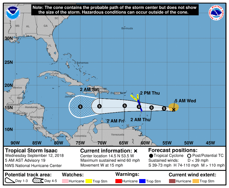 HELENE - Helene is a minimal hurricane in the Eastern Atlantic. It will contine it’s trajectory to the north, far away from the U.S. 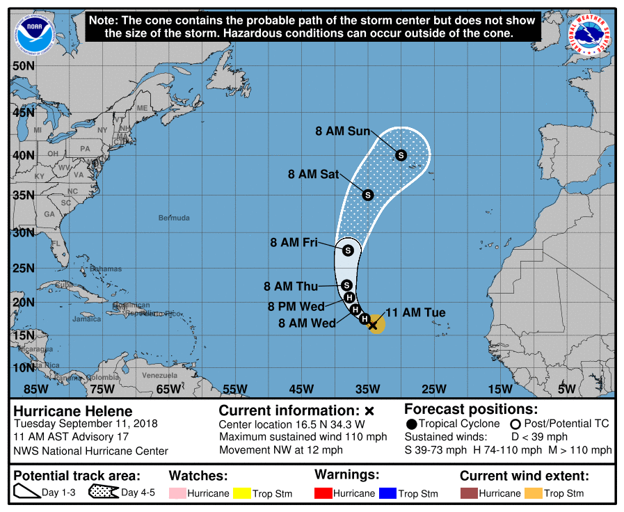 Invest 95L is also emerging from the Bay of Campeche at this point. The NHC gives it a high chance of developing to a tropicam depression or Tropicam Storm Joyce. Regardless of strength, this will impact the Texas Coast near Corpus Christi, then continue to move to the west. North Texas stays dry from this system.
|
Archives
March 2023
Categories |
 RSS Feed
