
|
CLOUDY WEATHER RETURNS - Today will be yet another cloudy day for North Texas, but at least the temperatures will be significantly warmer than the last times as a warm front moves to the north of us again. A few showers will be possible throughout the day, and afternoon highs will be in the mid 50s. Showers and storms will develop over North and Central Texas Friday afternoon and continue through Saturday morning. Rain could be heavy at times with a few strong storms possible. The SPC has defined a "marginal risk" (1/5 risk) of severe thunderstorms for parts of North Texas, generally along and to the east of I-35. 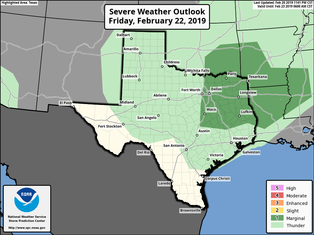 Some of the storms in the risk area could produce some hail and gusty winds at times. Might even watch for a very low-end chance of a brief tornado; we will remain vigilant and watch the radar throughout the evening. The high tomorrow will be in the upper 50s; a few degrees warmer than today. THE WEEKEND - Rain clears the area Saturday afternoon, and we will mention partly cloudy, breezy conditions for the rest of the day with afternoon highs in the mid to upper 60s. That storm system will lift to the northeast, posing a risk of severe storms for parts of the Mississippi River Valley. The SPC has defined an "Enhanced Risk" (level 3/5) of severe storms for parts of this area. 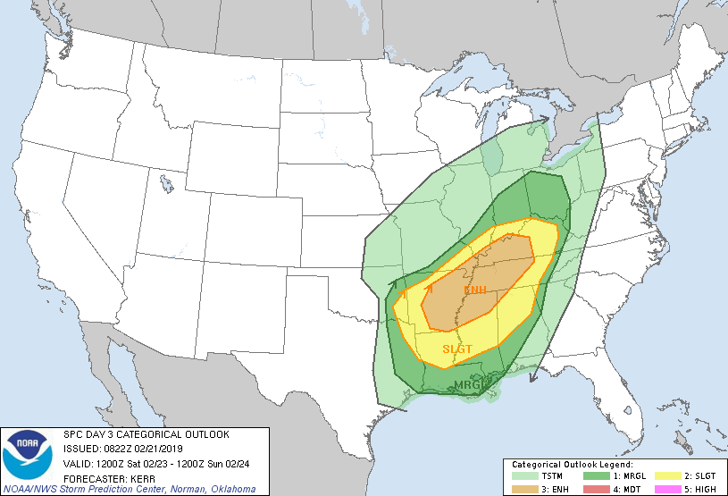 The main timeframe for severe thunderstorm development will come from about 3:00-12:00 midnight. The main threat will come from damaging winds and a few tornadoes from the discrete supercells, some of which could be strong. A high pressure builds over the state on Sunday... We will call it mostly sunny with highs in the low 60s. NEXT WEEK - Next week is shaping up to be a very pleasant week with highs mostly hovering in the 50s... See the Texas Weather Discussion Video for more details. 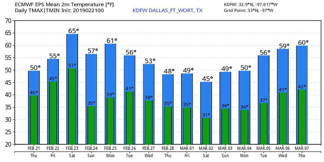 |
Archives
March 2023
Categories |
 RSS Feed
