
|
NOTHING OUT OF THE ORDINARY - Another typical late morning here in the great Lone Star State; more sun than clouds, winds at a calm level with temperatures in the mid to upper 80s. We will once again be in the mid to upper 90s later this afternoon with plenty of sunshine. Nothing really changes for the rest of this week or the weekend; hot and breezy days, fair nights, highs in the mid to upper 90s with more sun than clouds. WET WEEK AHEAD - Tropical moisture will advect from the Gulf this weekend, which will create statewide chances of showers and thunderstorms on Sunday through the much of next week. Rain will become more widespread on Monday with plenty of moisture, then we will continue to mention the chance of scattered thunderstorms for most of the week. Since they are more scattered in nature, it will be nearly impossible to forecast exact start/stop times. Just know that we will be under the gun for some rain starting Sunday afternoon. If you have any outdoor plans next week, just keep a close eye on the radar. Highs will be in the upper 80s to low 90s due to rain-cooled air. See the Texas Weather Discussion Video for more details. TROPICS - A disorganized batch of showers and thunderstorms in the Western Caribbean Sea will move northwest into the Southwest Gulf of Mexico later this week. Development looks highly unlikely, but it will push deep tropical moisture into the state during the weekend, bringing beneficial rain for much of Central and North Texas. The rest of the Atlantic Basin remains quiet. 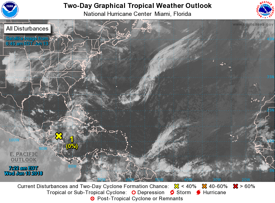 On our left hand, Bud has weakened to a tropical storm earlier this morning as it interacted with cooler water. This system will bring rain to the southern tip of Baha, California as it pushes to the northwest towards the southwest parts of the U.S this weekend. 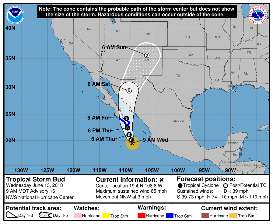 |
Archives
March 2023
Categories |
 RSS Feed
