
|
Dry Airmass - A very dry pattern persists for North Texas through the first half of the weekend. We only warmed to the low 60s yesterday, today we will be 10 degrees warmer. Today's high should be around 70-73 degrees. Today will also be relatively breezy with winds speeds in the 10-12 mph range. Due to the drought, almost two months of no measurable precipitation in some spots, low humidity, and above average temperatures in some spots, fire weather conditions are starting to become a concern. Elevated to near Critical fire weather conditions will persist today. There is no red flag warning in effect for North Texas, but be sure to check with your county for any local burn bans. Tomorrow morning will also be cold as temperatures drop to the mid 30s. Friday and the Weekend - Mostly pleasant days, clear, cool nights with highs in the low 60s and lows in the low 40s. We will see abundant sunshine in full force on Friday and Saturday. Clouds begin to increase during the weekend, and we will mention a chance of rain Saturday night into Saturday morning ahead of a passing surface front. We do note that there are model discrepancies in this solution, so the confidence in the amount of rain and timing is pretty low at this time. Otherwise, expect highs in the low 60s on Sunday. Next Week - The dry weather pattern persists for North Texas, and for now, no issues with any major weather event here in the Deep South... 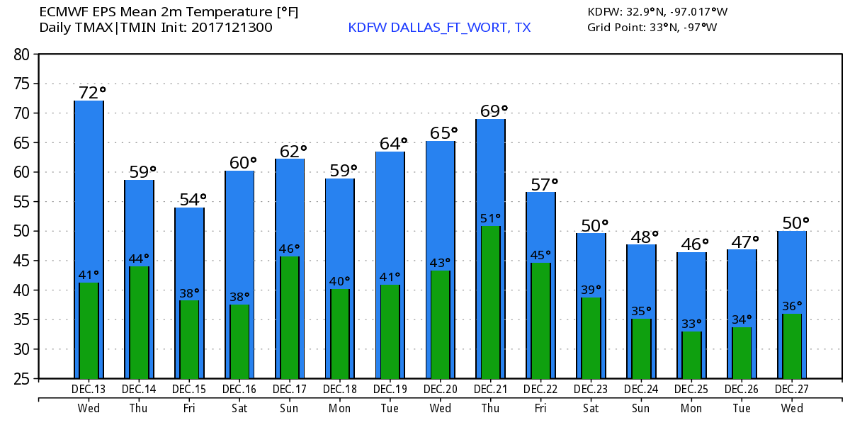 Christmas Snow?? - Although models have been trending towards a white Christmas in North Texas, there is simply no skill in forecasting the weather past ten days. However, we can take analog data that we have (sampling atmospheric conditions and comparing them to past weather events) and come to the conclusion that our chances of a White Christmas is low, but not zero. 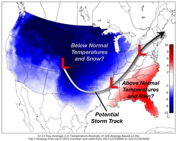 However, we remind you that this is still nothing but an educated guess. We will have a first peek of what Christmas may look like on December 18. See the Texas Weather Discussion Video for more details.
|
Archives
March 2023
Categories |
 RSS Feed
