
 A beautiful Sunday afternoon is taking shape in parts of North Texas. The cold air advection associated with the cold front yesterday is keeping us in the mid to upper 80s as of 1:00PM, but some of us could reach the low 90s today. The cold front also pulled some drier air down our way. You could tell from the wind shift to the north and it is less sticky outside. Dewpoints are in low to mid 60s right now. Our cold front right now is positioned near Killeen and Temple, just to the north of Austin. Highs will be in the lower 90s this afternoon, which will certainly feel much nicer than yesterday with the widespread triple-digits. Overnight lows will be 70 degrees in DFW, 67 in Canton, and even 63 in Bowie. Slightly cooler temperatures will stay to the north. MONDAY - Waking up to a beautiful morning in North Texas with temperatures in the upper 60s and low 70s while you head to work, a weakening complex of showers and thunderstorms will move in from west Texas during the day and affect North Texas during the afternoon and evening hours. Right now, there are two scenarios in the book for Monday: a) A weakening complex of showers and thunderstorms will move in from the Four Corners area and West Texas and produce widespread rainfall during the afternoon. North Texas could stay dry Tuesday morning. b) The majority of the day stays dry for North Texas. A complex of scattered showers and thunderstorms will move in from either Western/Central Oklahoma or along the Red River during the pre-dawn hours on Tuesday. Regardless of either scenario, North Texas will still be under the gun for more thunderstorms. Some of those storms could be on the strong side, producing gusty winds and hail. The SPC puts much of north Texas in the "marginal risk" (1/5) of severe thunderstorms for Monday through Tuesday morning. 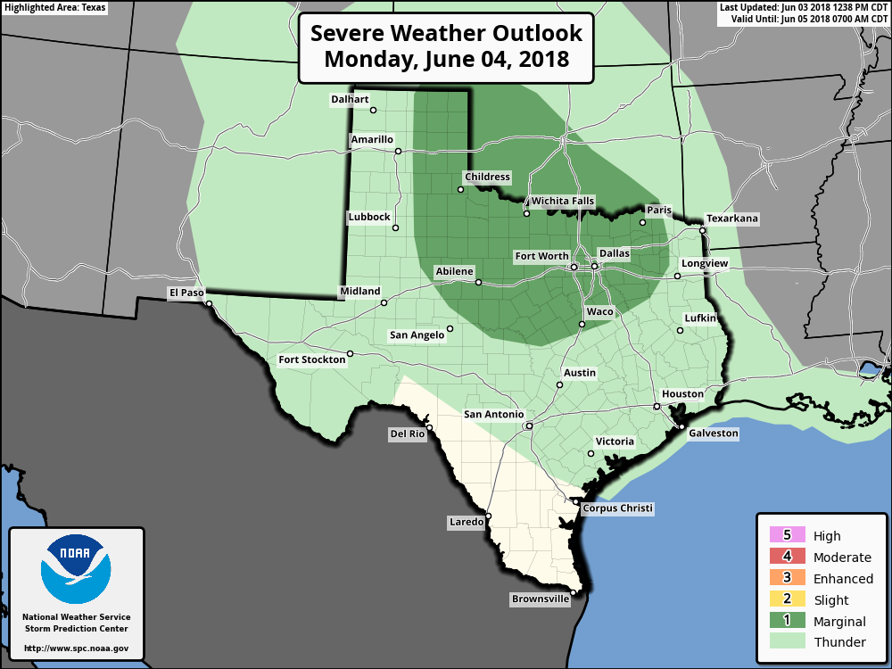 For both scenarios, Precipitable Water Values will be near 2 inches for much of the region, meaning any rain that falls will most likely be heavy rain, dumping around 1" to 1 1/2" of precipitation for the affected areas.
The airmass Tuesday morning will be very unstable, with increasing CAPE values ahead of the storm complex with sufficient moisture. Just know that any storms that do form will have the potential to produce damaging wind gusts alongside lightning and heavy rain. REST OF THE WEEK - North Texas stay dry after the storms move through Tuesday morning. We will creep back up to the mid to upper 90s with humidity values in the 40-45 percentile range as we head into the middle of June. The wind will shift back to the south as the warm front retracts to the north. TROPICS - We will keep a close eye on potential tropical mischief next weekend in the northwestern Caribbean, that could soon move into the Gulf of Mexico. |
Archives
March 2023
Categories |
 RSS Feed
