
|
There is very little change in our upper air pattern with a broad ridge encompassing much of the Continental U.S. As a result, expect more of the same thing today with mostly sunny skies under hot and humid conditions with highs in the upper 90s/low 100s. Precipitable water values remain above average, so a few isolated showers and thunderstorms could develop during the afternoon and evening hours for our western counties. Most places stay dry today. 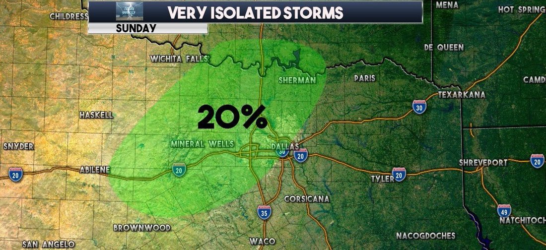 As noted in previous blog posts, the overall pattern for Texas will change as the upper level ridge moves westwards and parks itself in the Rockies by midweek. Not much changes here in North Texas. As indicated by the Precipitable Water Values, we pretty much stay in the same loop of hot and humid weather through the week. Highs will stay in the low 100s/but there is enough indication that highs could reach 105 by Wednesday. Not much change in our weather pattern towards the latter half of the week. We stay in the same loop with mostly sunny skies with hot and humid conditions with highs in the low 100s. This will spark drought conditions statewide and raise heat safety concerns. Be sure to look and see if your county is under a burn ban due to drought conditions and make sure you are practicing heat safety wherever you go. Looking out into next week, the GFS is convinced that we do not see any relief from the excessive heat during the week. The upper air pattern stays the same for much of the U.S. with very little change. That means we would continue to see afternoon highs in the upper 90s to low 100s during the peak of the day. The Atlantic Basin remains quiet with the exception of Subtropical Storm Beryl, which regenerated yesterday and is expected to weaken to a tropical depression by early Monday morning. 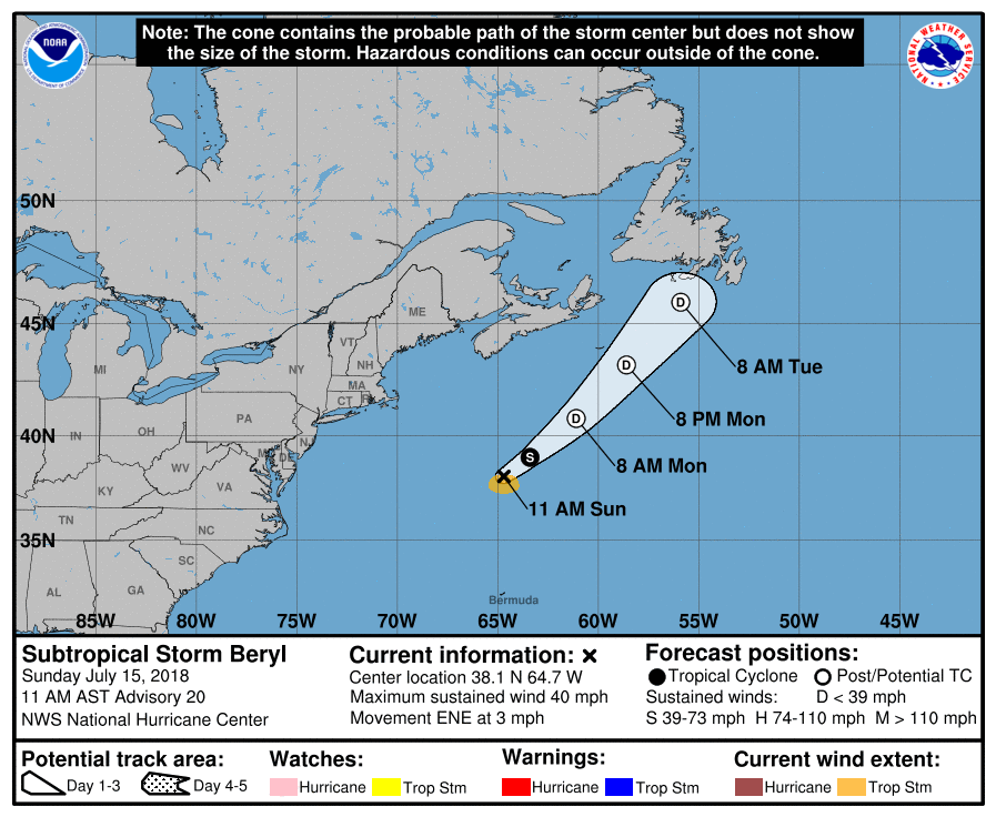 |
Archives
March 2023
Categories |
 RSS Feed
