
|
EARLY MORNING WAKE-UP CALL: After midnight, a lone thunderstorm out near Wichita Falls began making a turn to the south, cycling as it made its way to the metroplex. By the 4:30-5:30 timeframe, the storm produced frequent cloud to ground lightning, some damaging winds, and golf-ball sized hail. The NWS Office in Fort Worth measured 1.5" hail at 4:26 am. 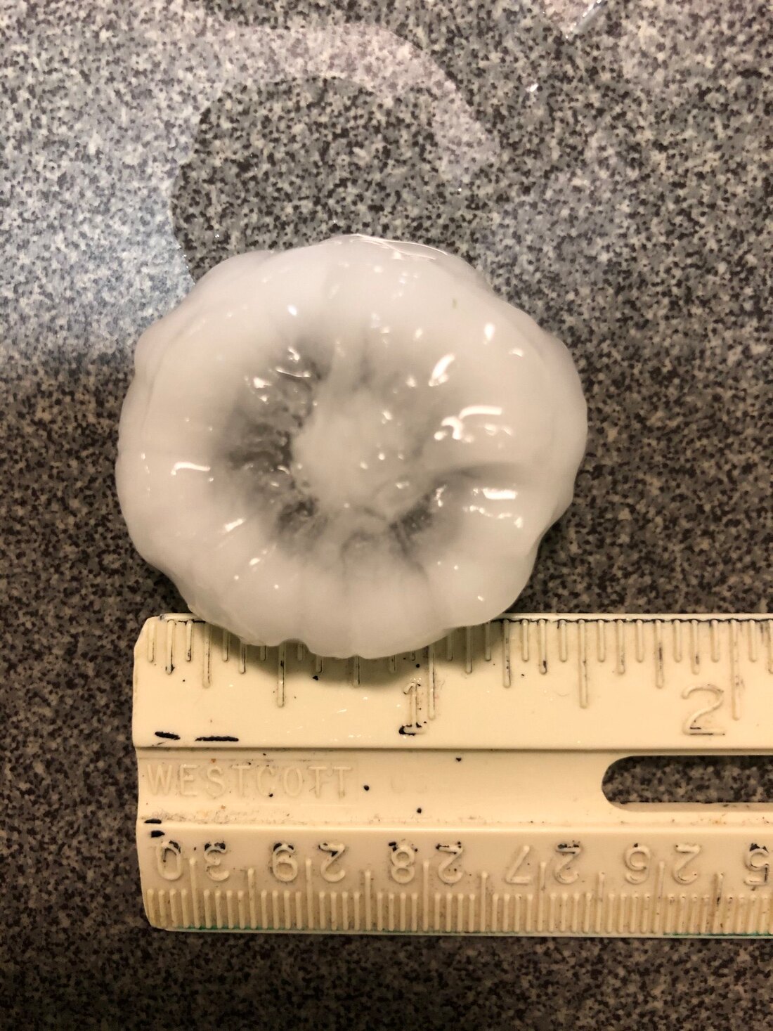 The storm has weakened and has subsequently continued to push to the east/southeast. We will remain partly sunny and dry for at least the early afternoon hours, with highs in the upper 80s to low 90s. SEVERE WEATHER LIKELY OVERNIGHT: A rather unstable airmass is expected to hold and move south this evening into tonight, and high resolution data suggests rapid development of severe thunderstorms at around sunset just to the south of Wichita Falls. SPC has issued a wind-driven "moderate risk" (level 4 of 5) of severe storms for parts of northeast Texas and East Oklahoma. The rest of North Texas is surrounded by an "enhanced risk" (level 3 of 5) of severe storms, extending down to Central Texas. UPDATE: AS OF 11:30 TODAY, DFW HAS NOW BEEN ADDED TO THE MODERATE RISK OF SEVERE WEATHER. THE RISK OF SIGNIFICANT WIND GUSTS AND VERY LARGE HAIL IS INCREASING. 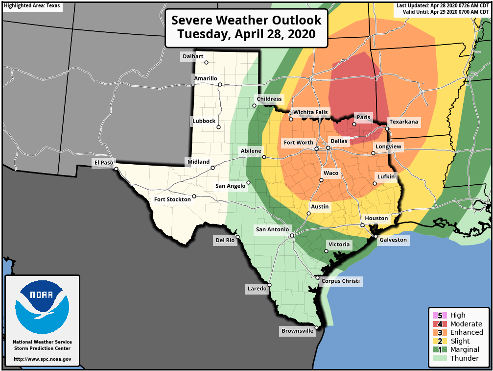 TIMING: Storms will likely develop near Wichita Falls after 7PM and move southward through the region overnight. The broad window for severe storms in North Texas will be from 8PM to 7AM tomorrow morning. The focused window will be from 10PM to 4PM through the metroplex.
THREATS: Any storm clusters that form during the early stages will have the possibility of becoming quite severe, posing the threat of very large hail (up to the size of tennis balls), damaging winds, and tornadoes. Any clusters will very quickly congeal into a QLCS (quasi-linear convective system), mainly posing the risk for damaging winds, some up to hurricane force gusts of 80 mph or more (remember, damaging straight-line winds can produce tornado-like damage). The highest tornado probabilities will be focused in the northeast corner of Texas and extreme southeast Oklahoma. RAINFALL: Rain amounts of around 1-1.5" inches is possible across the region, with isolated higher amounts. Some flooding is possible with torrential rainfall. CALL TO ACTION: Be sure to have multiple way of receiving warnings during the overnight hours (don't rely on a siren!!!). In your safe place, make sure you have helmets for everyone in your family. If you are in a mobile home, know your location of a site built-shelter, and how to get there quickly. This is the day to treat severe thunderstorm warnings very seriously. Severe thunderstorms can and occasionally produce tornadoes and tornado-like straight line wind speeds. Make sure your NOAA Weather Radio is on overnight, so it can wake you up if you are sleep while these storms are coming through. Also, make sure you are in our text-messaging system (text @apexstorm to 81010). Donovan Neal Owner - ApexStorm |
Archives
March 2023
Categories |
 RSS Feed
