
|
CALM SPRING WEATHER TODAY - We project a high in the 76-81 degree range across North Texas this afternoon under a mostly cloudy sky. While there is moisture surging south from the Gulf, an upper ridge and a strong cap will keep the region mostly dry today. However, an isolated shower or two can not be ruled out this afternoon, but the chance of any one spot seeing rain is only 5-10%; not really worth mentioning in any forecast. ACTIVE WEATHER PATTERN BEGINS TOMORROW - A substantial shortwave is expected to lift northeastward across the south-central High Plains during the pre-dawn hours tomorrow, setting the stage for an active severe weather day from Iowa down to the South Plains in the afternoon. 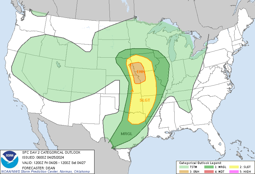 While the greatest threat of severe weather remains well to the north of North Texas, we do note the standard "slight" risk (level 2/5) of severe storms in DFW metroplex, extending as far south as Corsicana and up north through the Ark-La-Tex region. 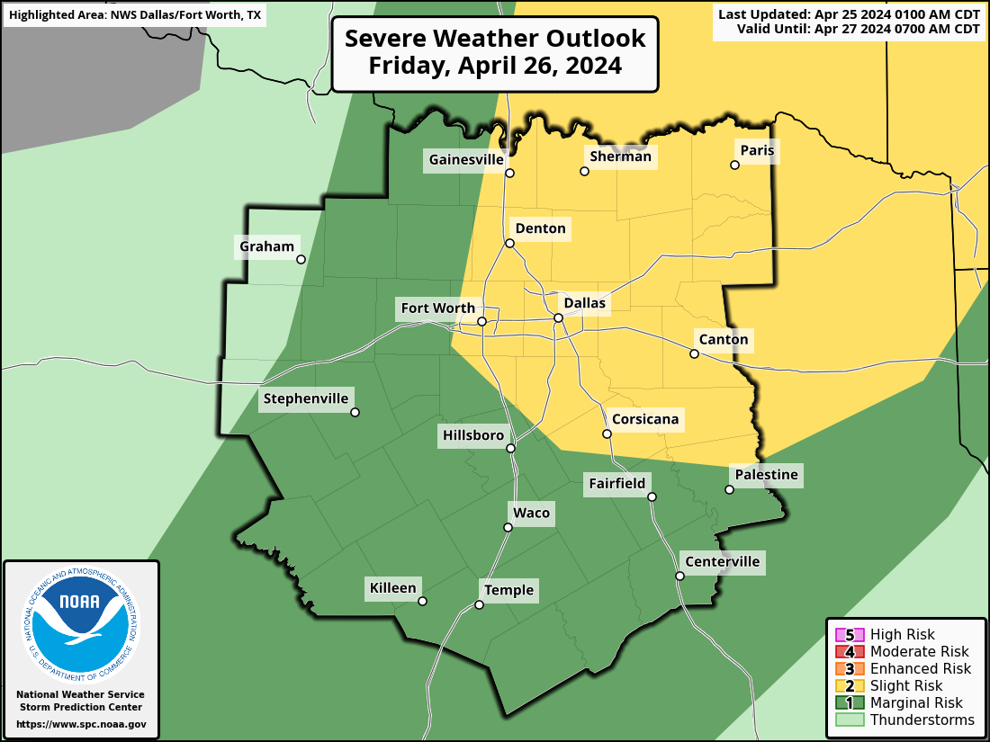 FRIDAY MORNING - The passing of the Pacific front in addition to a weak cap should allow clusters of strong to severe storms to develop near Abilene during pre-dawn, moving northeastward into the metroplex right in time for morning rush hour. As typical with these severe weather threats, large hail and wind damage remain the most primary concerns, however, an isolated tornado is definitely not out of the question. 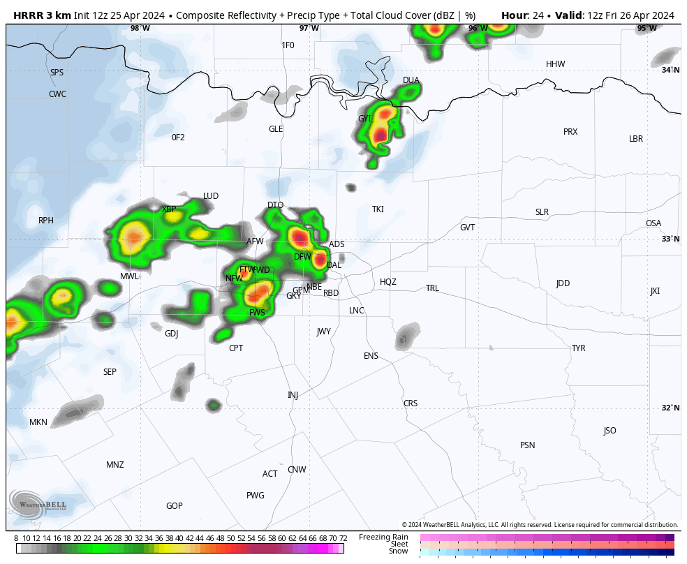 HRRR (High-Resolution Rapid Refresh) model valid tomorrow at 7:00a. Once morning convection pushes past the region, clouds will exit the region early in the afternoon, which should allow temperatures to warm to the 85-90 degree range. THE WEEKEND - As a negatively tilted trough provides dynamic support while moisture from the Gulf surges northward, the stage will be set for what could be a classic Central Plains tornado outbreak Saturday afternoon and evening across Central Oklahoma and Kansas. Currently, there is an "enhanced" risk (level 3/5) of severe storms for that region, however, it is a matter of when, not if, higher severe probabilities are introduced for the region in question over the next couple of days., 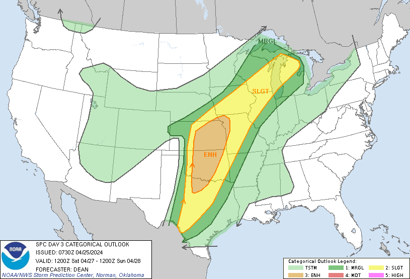 While the greatest threat of severe storms once again remains well to our north, the enhanced risk remains to the north and west of the metroplex, while much of the region maintains the standard "slight" risk of severe storms. 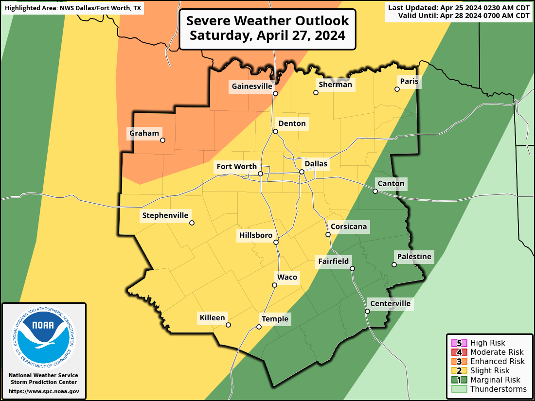 SATURDAY - While the risk for storms tomorrow morning is very clear, Saturday presents a complex forecast, one that can not be properly communicated through the use of common weather apps. At this time, morning showers appear possible Saturday, but it is unclear the extent of how numerous these showers may be. This can very well play a role in how severe afternoon/evening storms become. If there is minimal convection in the morning, severe thunderstorms become more likely in the afternoon/evening as the environment need not "recover" from morning convection. In this case, a few supercell thunderstorms will be possible with the potential for large to very large hail stones and perhaps a couple of isolated tornadoes. It is still too early to determine exact placement of the front to ascertain start time of severe storms. Not everyone will see severe weather this weekend, however, widespread rain becomes likely Saturday night into Sunday late morning, especially for those closest to the Red River. Rain amounts will range from 1-2" regionwide with potential for 3"+ measurements along the Red River where storms have more potential to train through the night. We also note the possibility of overnight flooding. The Weather Prediciton Center has a "slight" risk of excessive rainfall for North Texas. 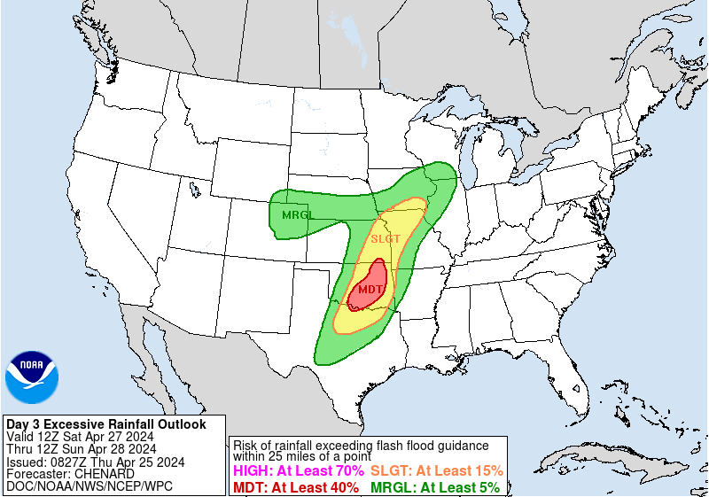 Once rain exits the region in the afternoon, clouds will begin to clear from west to east. We project a high in the low 80s. NEXT WEEK - Active weather continues into the next week multiple rounds of thunderstorms likely throughout at least the early week. Monday and Tuesday evening along with Wednesday afternoon will pose multiple chances of storms, However, confidence is too low to mention any severe probabilities at this time. 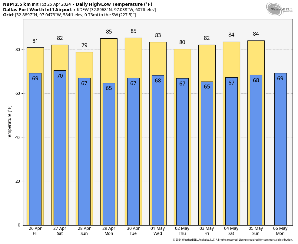 ON THIS DATE IN 1994 - A localized tornado event, part of a multi-day Central and South plains tornado outbreak, spawned 6 tornadoes in the metroplex. Four of them, rated F0, caused minimal to no damage across Ellis, Dallas, and Tarrant counties. However, an F2 tornado touched down in DeSoto, damaging over 200 homes, a school, and City Hall. Damages were estimated at $50 million from this tornado. Lastly, a 1/2 mile wide F4 tornado destroyed 80% of historic downtown Lancaster, killing three people and injuring 48 people.
Donovan Neal Owner - ApexStorm |
Archives
April 2024
Categories |
 RSS Feed