
|
REFRESHING CHANGE: After a long awaited front came through North Texas Monday afternoon, dry air continues to flow into the state with a partly cloudy sky, lower humidity levels, and below average temperatures. DFW is reporting a low of 74° this morning while other sites report lows in the low to mid 60s, some cities even seeing record lows, like Abilene. We will probably reach the upper 80s today, but that is still ten degrees below our average high. Tonight will be fair and cooler once again as temperatures drop into the 60 degree range with upper 50s possible near the cooler valleys. TOMORROW AND FRIDAY: Not much change. Mostly sunny days, low humidity levels for summer, followed by fair, pleasant nights. Highs will be in the low 90s tomorrow, followed by mid 90s on Friday. THE WEEKEND: Moisture levels will rise, humidity values will increase, and we will forecast hotter, humid weather with highs in between 92-97°. NEXT WEEK: We will go with the standard mid-summer forecast through the weekend. Partly cloudy, hot, and humid each day with the risk of a passing afternoon shower in a spot or two. Highs will mostly be in the mid 90s, right at seasonal averages for late July. See the Texas Weather Discussion Video for more details. 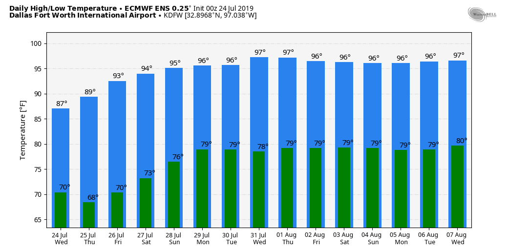 TROPICS: Tropical Depression Three dissipated yesterday morning off of the Florida coast. The NHC is now looking at a disturbance in the vicinity of the stalled front across the Gulf of Mexico, giving it a 20 percent chance of tropical depression or storm formation. 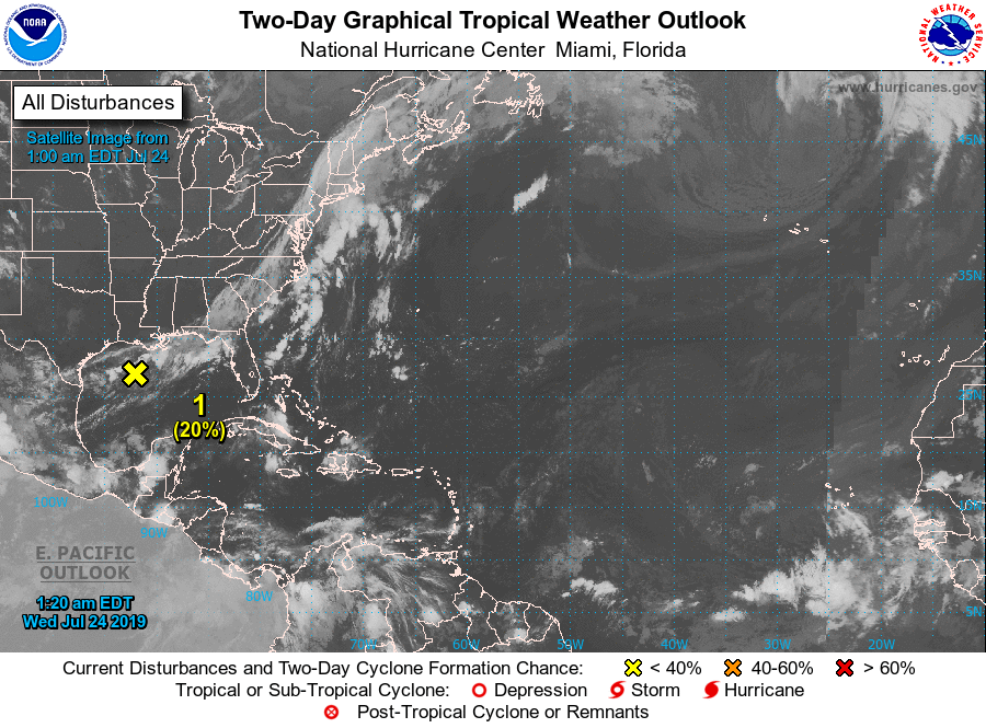 |
Archives
March 2023
Categories |
 RSS Feed
