
|
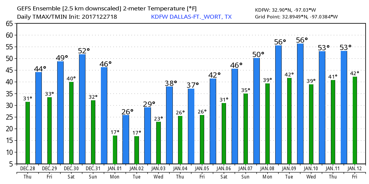
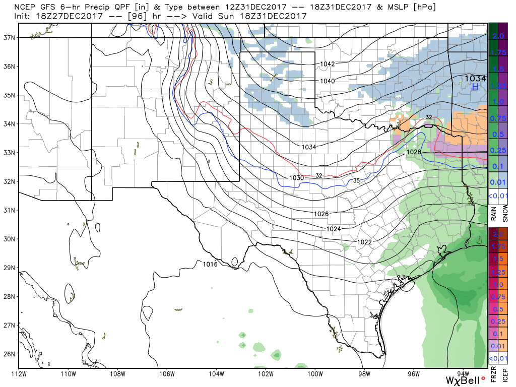
NEW YEAR'S FORECAST DISCUSSION PT. 2 - As I stated in yesterday's post, there is potential for wintery precipitation throughout the day on Sunday over the central part of North Texas, including the DFW Metro. Because moisture will be almost non-existent, accumulation, if any, will be very light. However, since this will most likely be in a arctic airmass, some travel impacts are possible. Some light snow, with some freeezing rain or perhaps sleet, will be possible for areas along and mostly north of Interstate 20 Sunday evening, and should all come to an end at around midnight as an arctic airmass pushes in from the north. Here are some of the important notes... *The ECMWF (European Global) model suggests that snow amounts of less than one inch will be possible Sunday evening. Meanwhile, the last few runs of the GFS (American Global Forecasting System) model show nothing. Since the European tends to outpreform the GFS in these situations, we wil continue to mention a chance of light showers with the chance of light snow Sunday evening. *With little to almost no moisture avaliable, keep in mind that there is always the chance that no precipitation will fall in this time frame over DFW with the exception of a few flurries, a few slow pellets, or freezing rain. *However, if the European model is correct, precipitation will be possible beginning Sunday morning in the form of light showers. When the temperatures begin to fall Sunday afternoon/evening, a wintery mix and/or light snow will be possible across North Texas. *We currently do not know if we would be on the southern or northern periphery of the system, just know that along and north of I-20 is where the greatest chances of wintery precipiation lie. Just keep in mind that it is way too early for a specific forecast, and there is no skill in trying to predict start/stop times three days out. Just use this as a heads up as to what's to potentially come, and no, do not cancel any travel plans. NEXT WEEK - We do note that there is great confidence in the coldest air thus far getting here next week. On New Year's, highs will only be in the 20s and lows in the teens. Some parts of North Texas could stay below freezing for three consecutive days. The bottom line is, plan on very cold, arctic air. keep in mind that this is posted Thursday morning @ 9:50P. Please make sure that you are using fresh, updated information as the forecast is guaranteed to change. 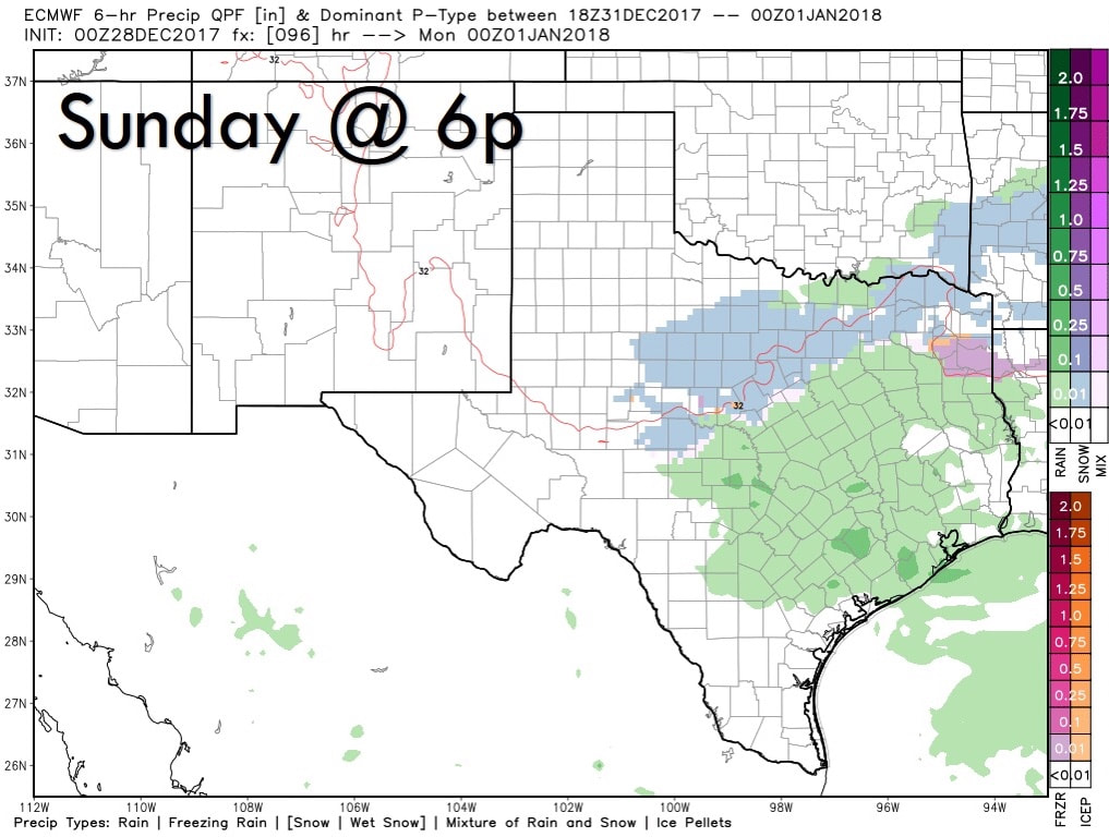 NEW YEAR'S EVE WEATHER DISCUSSION -- As we get closer towards the end of 2017, we are starting to get better model consistency which leads to more forecast confidence for this weekend. What we are certain about... - There will be another chance for scattered showers throughout New Year's Eve with the chance of some freezing rain involved (maybe some sleet pellets, but mostly freezing rain) beginning during the afternoon hours. - Very cold air sets up over much of the Continental United States afterwards, and temperatures will fall way below freezing for much of North Texas. Many locations will most likely fall into the teens Monday morning. - Global models suggests that any precipitation (if any) will be very light, and any measurable rainfall should stay below a tenth of an inch. But keep in mind that any amount of rain in very cold conditions would cause problems for roadways and especially bridges. - This arctic air will stick with us for the remainder of the week with some places struggling to reach above freezing levels for 96 cumulative hours. - Much of the winter weather will stay north of North Texas, but not too far from here. What we are uncertain of... - How much precipitation of any kind we receive. One way or another, amounts should stay very light. - If we will stay on the western periphery of the system. - What time the potential freezing rain starts and ends. - The extent of any potential travel impacts from this. If you are plan on traveling to a party or elsewhere, you do not need to cancel your plans. Be sure that you are using current, fresh information every day. Remember, if you are looking at a forecast 8-12 hours ago, you are using bad information.
Welcome to December, which is also the first day of Meteorological winter! November 2017 Summary - DFW had the 6th warmest November on record with a mean temperature of 62.4 degrees, about 6 degrees above average. Additionally, we have had the 28th driest November with only 0.81 inches of rain recorded in DFW. The driest November on record is currently in 1903 when no Precipitation was record. 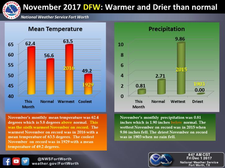 Meteorological Winter - Some of you have been wondering what Meteorological seasons means. These seasons are based off of the temperature change that usually takes place within these months in the season. For example, today marks the first day of winter, which runs through February 28. Then March 1 would mark the beginning of spring, then June 1 would be the start of summer. The difference between meteorological seasons and astronomical seasons is that astronomical seasons use the suns location in relation to Earth to determine the seasons. Cold? - Yes. A new surge of arctic air is due in the US by mostly the latter half of next week, which would obviously create frost and maybe some snow problems for some parts of the U.S. In North Texas, this will bring temperatures down into the mid 50s for highs and mid 30s for lows. Additionally, an arctic front will bring a chance of scattered showers and storms during the latter half of the week, potentially with some sleet in the mix. 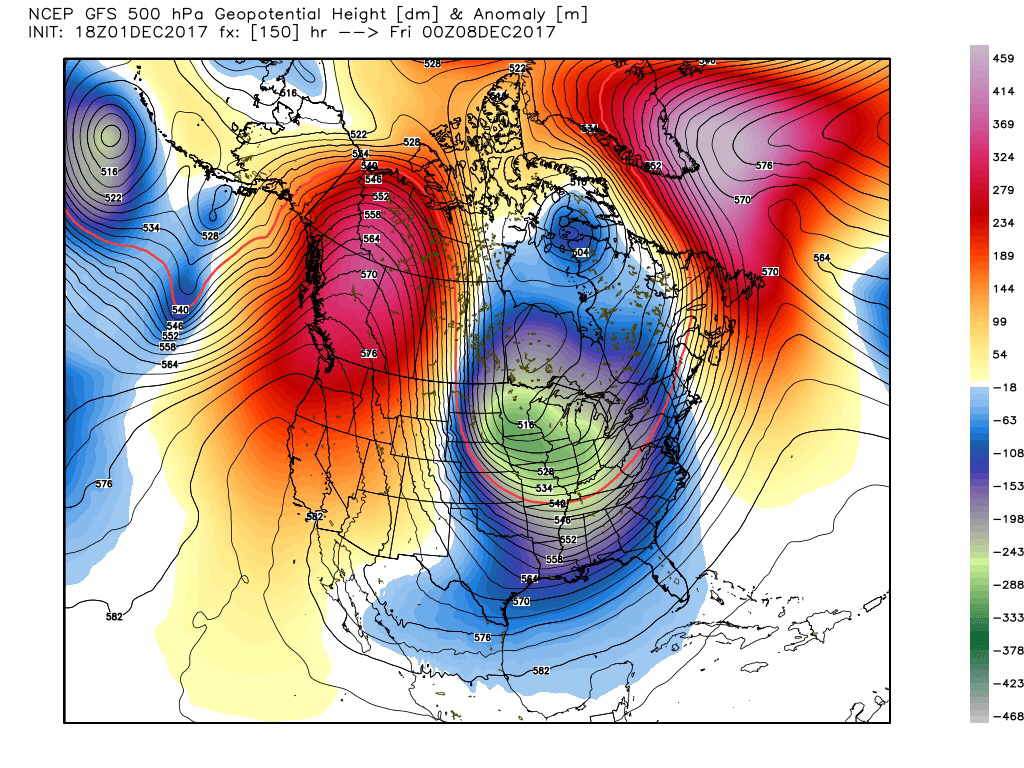 The bottom line is, the coldest air of the season thus far arrives during the middle of next week. However, we do issue a word of caution... This type of weather typically awakens the “keyboard meteorologists” who loves to post voodoo blizzards that come from a deterministic computer run during the 10-16 day time frame. If you don’t know, most of these voodoo blizzards never show up, and is overall the worst possible way to forecast the weather. But these keyboard meteorologists do it simply for the clicks, likes, shares, and retweets. If you see of these posting these absurd model solutions, do us all a favor, and do not like, share, or retweet. Please also be aware of this before you or your friends post a deterministic model run on social media. Have a reliable source of getting accurate, up to date weather information. 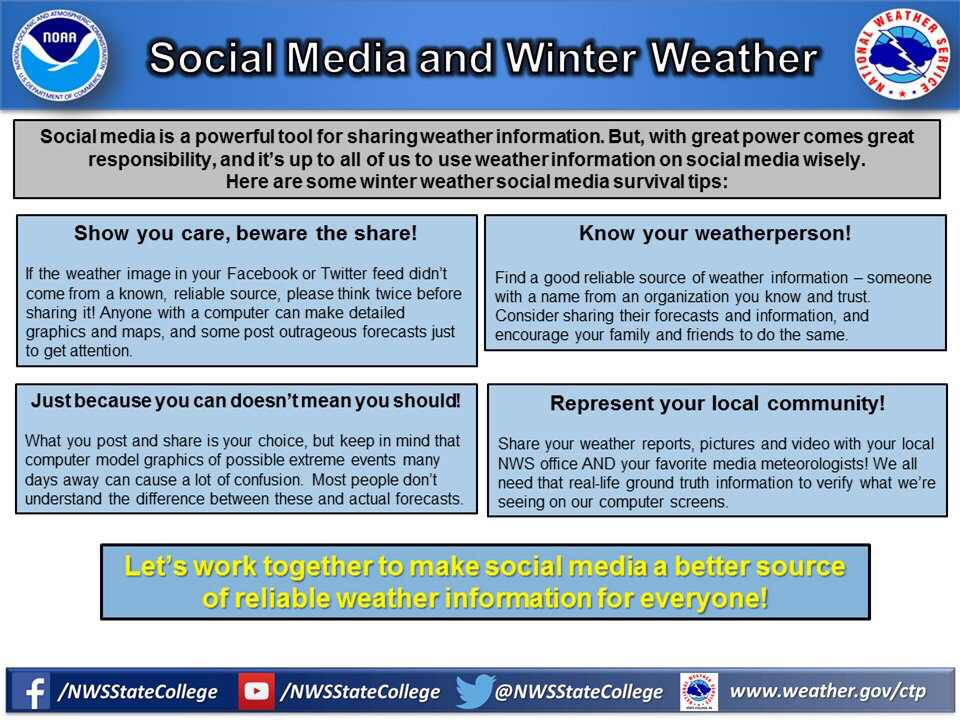 |
AuthorWrite something about yourself. No need to be fancy, just an overview. Archives
June 2018
Categories |
 RSS Feed