
|
NEW YEAR'S FORECAST DISCUSSION PT. 2 - As I stated in yesterday's post, there is potential for wintery precipitation throughout the day on Sunday over the central part of North Texas, including the DFW Metro. Because moisture will be almost non-existent, accumulation, if any, will be very light. However, since this will most likely be in a arctic airmass, some travel impacts are possible. Some light snow, with some freeezing rain or perhaps sleet, will be possible for areas along and mostly north of Interstate 20 Sunday evening, and should all come to an end at around midnight as an arctic airmass pushes in from the north. Here are some of the important notes... *The ECMWF (European Global) model suggests that snow amounts of less than one inch will be possible Sunday evening. Meanwhile, the last few runs of the GFS (American Global Forecasting System) model show nothing. Since the European tends to outpreform the GFS in these situations, we wil continue to mention a chance of light showers with the chance of light snow Sunday evening. *With little to almost no moisture avaliable, keep in mind that there is always the chance that no precipitation will fall in this time frame over DFW with the exception of a few flurries, a few slow pellets, or freezing rain. *However, if the European model is correct, precipitation will be possible beginning Sunday morning in the form of light showers. When the temperatures begin to fall Sunday afternoon/evening, a wintery mix and/or light snow will be possible across North Texas. *We currently do not know if we would be on the southern or northern periphery of the system, just know that along and north of I-20 is where the greatest chances of wintery precipiation lie. Just keep in mind that it is way too early for a specific forecast, and there is no skill in trying to predict start/stop times three days out. Just use this as a heads up as to what's to potentially come, and no, do not cancel any travel plans. NEXT WEEK - We do note that there is great confidence in the coldest air thus far getting here next week. On New Year's, highs will only be in the 20s and lows in the teens. Some parts of North Texas could stay below freezing for three consecutive days. The bottom line is, plan on very cold, arctic air. keep in mind that this is posted Thursday morning @ 9:50P. Please make sure that you are using fresh, updated information as the forecast is guaranteed to change. 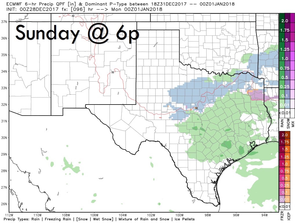 |
AuthorWrite something about yourself. No need to be fancy, just an overview. Archives
June 2018
Categories |
 RSS Feed
