
|
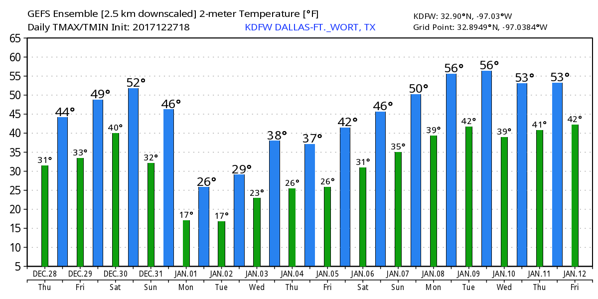
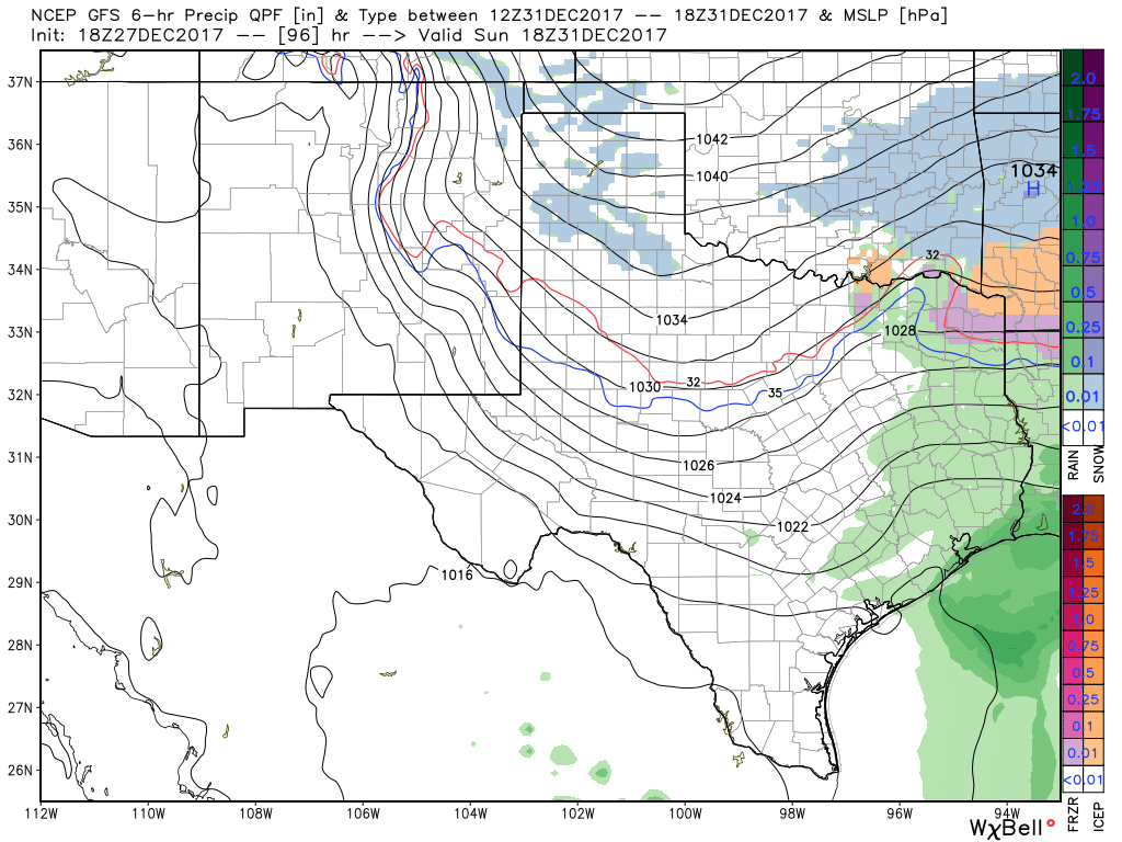
NEW YEAR'S EVE WEATHER DISCUSSION -- As we get closer towards the end of 2017, we are starting to get better model consistency which leads to more forecast confidence for this weekend. What we are certain about... - There will be another chance for scattered showers throughout New Year's Eve with the chance of some freezing rain involved (maybe some sleet pellets, but mostly freezing rain) beginning during the afternoon hours. - Very cold air sets up over much of the Continental United States afterwards, and temperatures will fall way below freezing for much of North Texas. Many locations will most likely fall into the teens Monday morning. - Global models suggests that any precipitation (if any) will be very light, and any measurable rainfall should stay below a tenth of an inch. But keep in mind that any amount of rain in very cold conditions would cause problems for roadways and especially bridges. - This arctic air will stick with us for the remainder of the week with some places struggling to reach above freezing levels for 96 cumulative hours. - Much of the winter weather will stay north of North Texas, but not too far from here. What we are uncertain of... - How much precipitation of any kind we receive. One way or another, amounts should stay very light. - If we will stay on the western periphery of the system. - What time the potential freezing rain starts and ends. - The extent of any potential travel impacts from this. If you are plan on traveling to a party or elsewhere, you do not need to cancel your plans. Be sure that you are using current, fresh information every day. Remember, if you are looking at a forecast 8-12 hours ago, you are using bad information.
|
AuthorWrite something about yourself. No need to be fancy, just an overview. Archives
June 2018
Categories |
 RSS Feed
